|
On Saturday
12-Jan-2008 I took a short walk to visit the remains of the Montour
Railroad around Mile post 30. This is one of the few remaining areas of
the Montour that have not been 'sterilized' by conversion to the
Montour Trail. Don't get me wrong, I am glad the trail has been built,
better than housing developments that would remove all traces of the
railroad. But when sterilization takes place much of the remaining
history of the Montour is carted away. Ties, ballast, old rail, engine
parts, spilled loads, plates, spikes most gone when the trail is
constructed.
I set out on
this trip by myself and wanted to visit the area before complete
conversion over to the trail. For those who have not taken the time to
make Montour visits to 'pristine' areas before the trail, you really
need to make the time. When you walk the the old RoW the ghosts still
linger. You can imagine steam engines belching smoke and cinders, the
smell of SW-9's working the hills with full loads of coal for Champion
and squealing wheels. The piercing headlamps exiting the tunnels and
lighting the surrounding hills and trees.
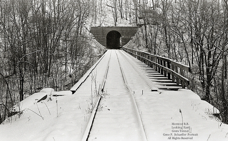
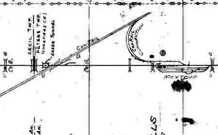
Below is the
section of the track chart of the area.
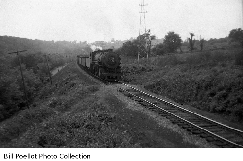
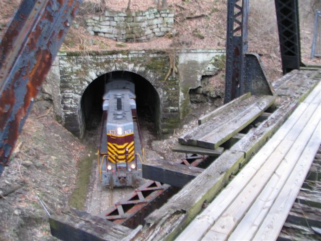
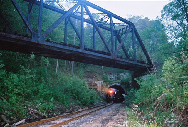
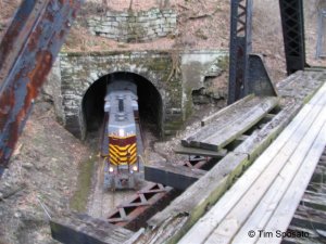
Above is a photo of eastbound coal loads at Rowley, MP 30.1, with
Engine 24. This was the afternoon of my last day of school at
the
end of May, 1949. With three months of freedom ahead of me,
it
just didn’t get any better. The day had started with
brilliant
sunshine and ultra clear conditions, but about the time of this picture
I noticed that high clouds were slowly moving in. We just had
a
half-day of attendance on that final date and got home bearing our
report cards and anything else that didn’t belong at school.
After lunch I took my first camera, a 127 size Baby Brownie Special and
headed out for adventure. This is what I saw about 3:30
PM.
That’s Hahn Drive in the picture at about the location of the old farm
underpass beneath the railroad.
An interesting feature in this picture is the steel tower carrying the
high tension electric line that ran along the railroad from about
Thompsonville to Henderson, maybe further. This line seems to
be
labeled P.C. Co. on your valuation map at Greer Tunnel. A
gang
came along in the summer of ’48 or ’49 and painted those
towers.
They must have worked for a contractor named Kuder because on a number
of abutments they left a painted tag in 1 ft high letters stating the
Kuder Kids Were Here. It’s too bad I didn’t get a picture of
that. It was a serious defacement that remained visible for
years.
This picture shows the openness of the countryside at that time.
Bill Poellot
Below is an
aerial view of the Greers area. I've added text and the basic route of
the tunnels. Greers is slightly curved as shown on the image.
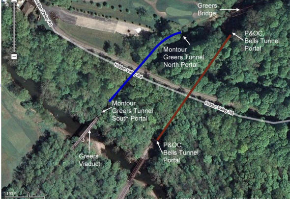 Google Link
I started the
journey by parking nearby and climbing the hill near the bridge over
Valley Brook Rd. This is not the best place to start as I found out
later. It is better to take Buckeye St. and park where the street
crosses
the right-of-way. The first thing I noticed was the work being done on
the bridge over Valley Brook Road. It is very muddy in the area from
the heavy machinery moving across the area.
There is an
access road that comes down the hill across the MROW and down to
Buckeye Rd. This is a good place to park and go either way Greers
tunnel or back toward #4. There was a road that came out here and went
back to the widows house. - Carter Roth
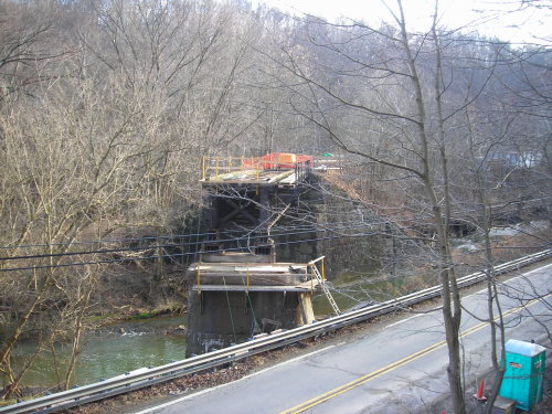
Bridge work over Valley Brook Rd.
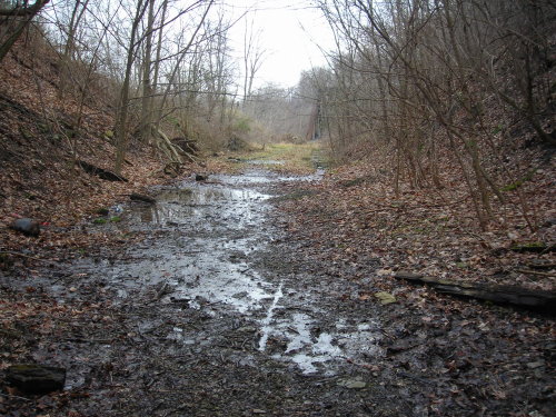
From here I
started heading to the north portal of Greers Tunnel. Along the way
were the regular assortment of ties that have been moved to the side.
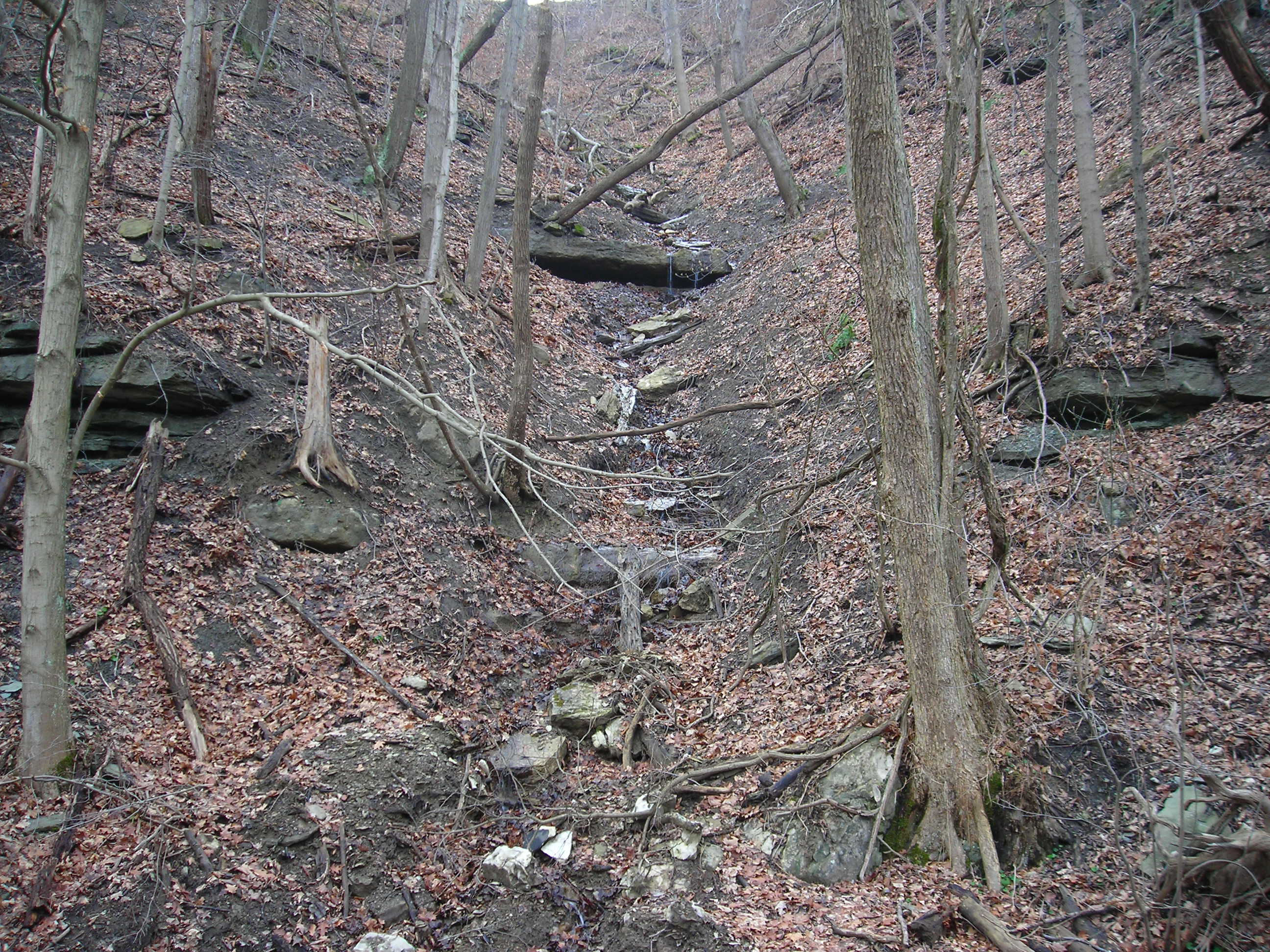
Most of the RoW before reaching the Buckeye St crossing was muddy and
strewn with large boulders. There is a small stream running down the
hillside on the left as you walk, probably from a spring higher up the
hill.
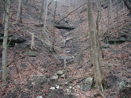
Small waterfall cascades down the hillside
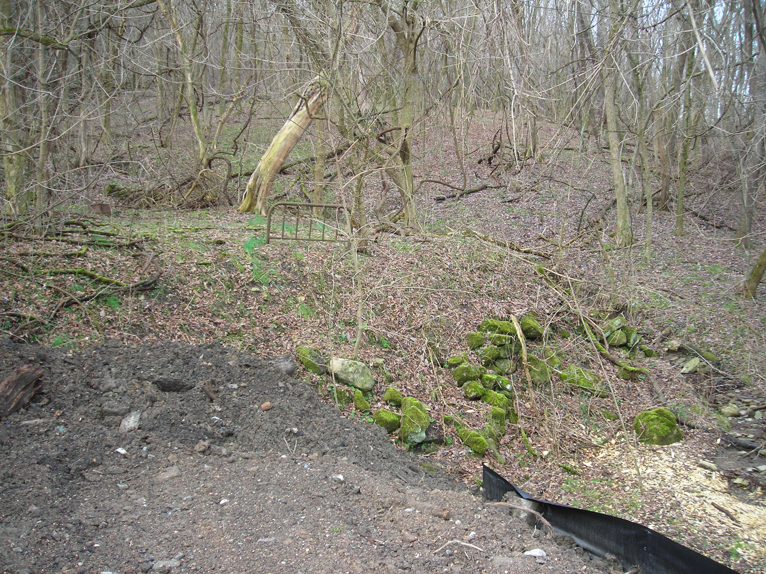
As you move
along you will notice an old foundation and headboard from an old bed.
This is the remains of the residence of Widow Johnson. Mrs. Johnson
lived on a farm and often was the recipient of the generosity of the
Montour employees. In the old steam days they would shovel coal from
the train for her to burn in her furnace. As I paused at the foundation
I wondered how she would get to market as there are no road access to
her house. You can see in the image that there is some work going on
near her house. I hope it's not removed by trail construction.

Widow Johnson's house foundation
After the Widow
Johnson's house you will cross Buckeye St. On the south side of Buckeye
St the RoW becomes more pristine without any development work being
done. The Row is drier and more solid with a covering of cinders.
Looking down to the right you will see that the rail follows Chartiers
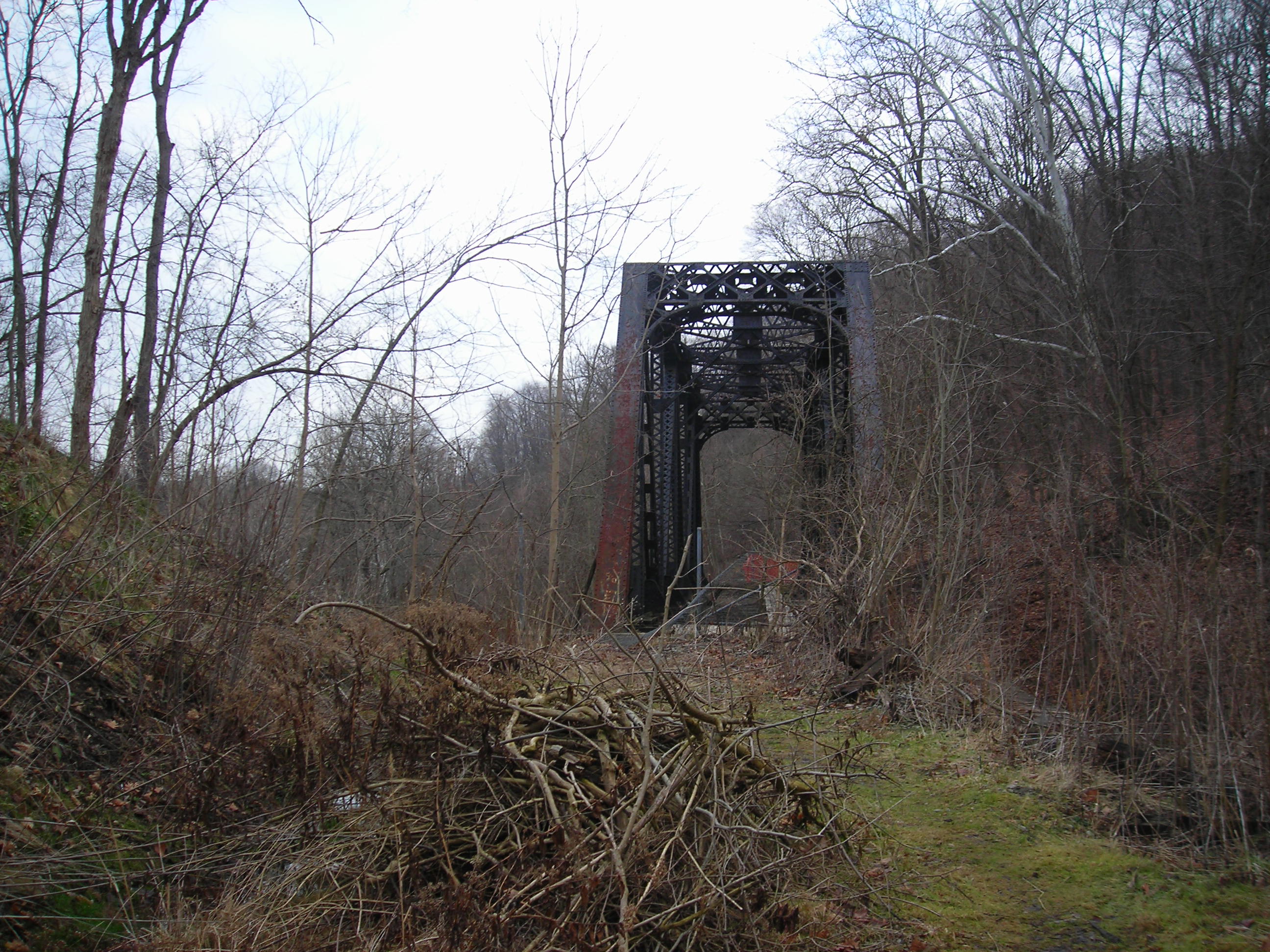
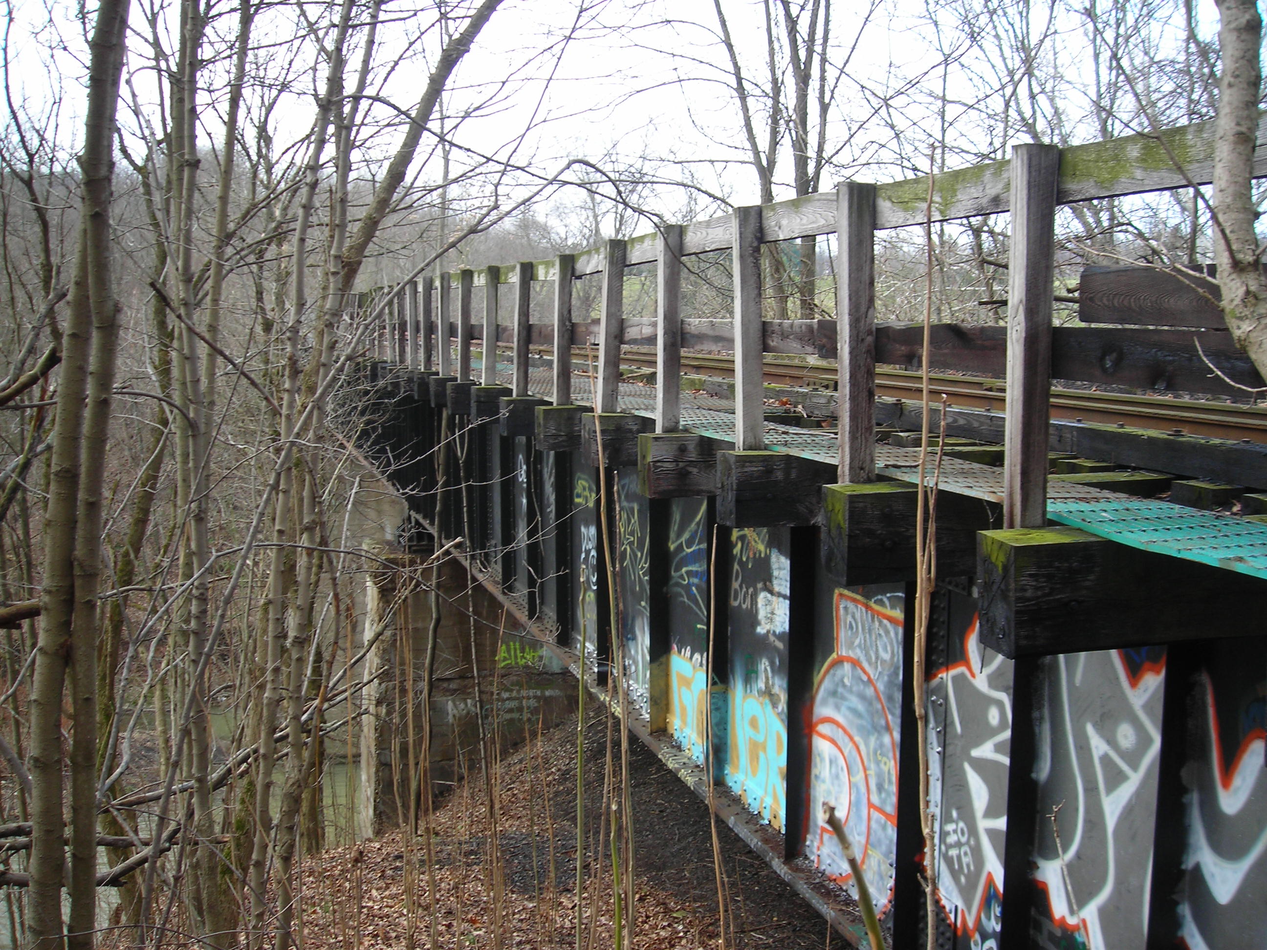
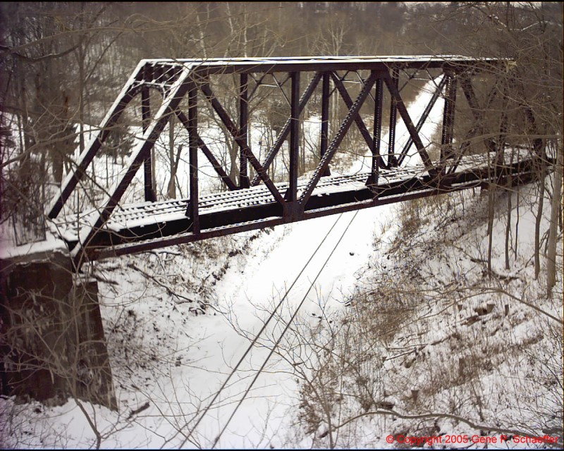
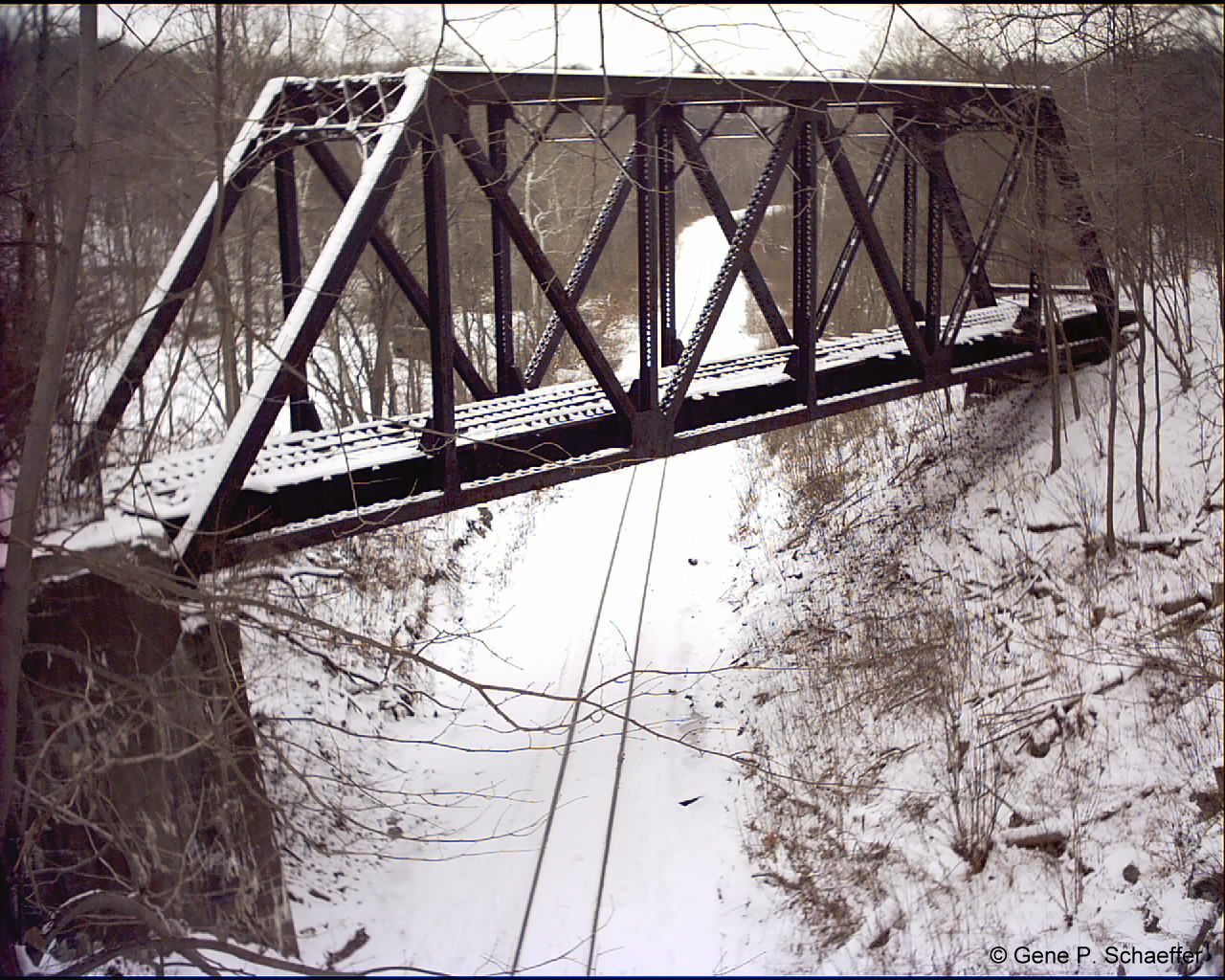
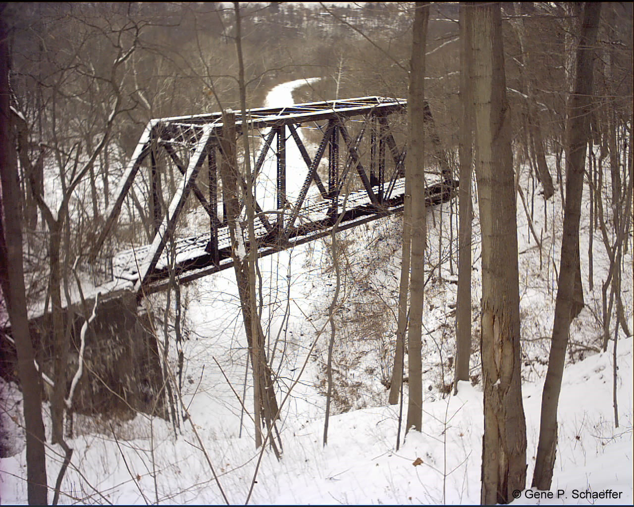
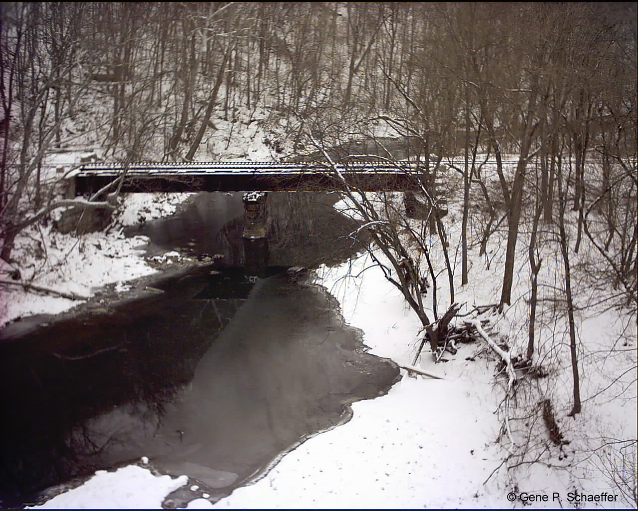
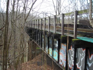
Creek well below. Slowly rising out of the trees is what I refer to as
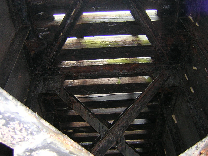
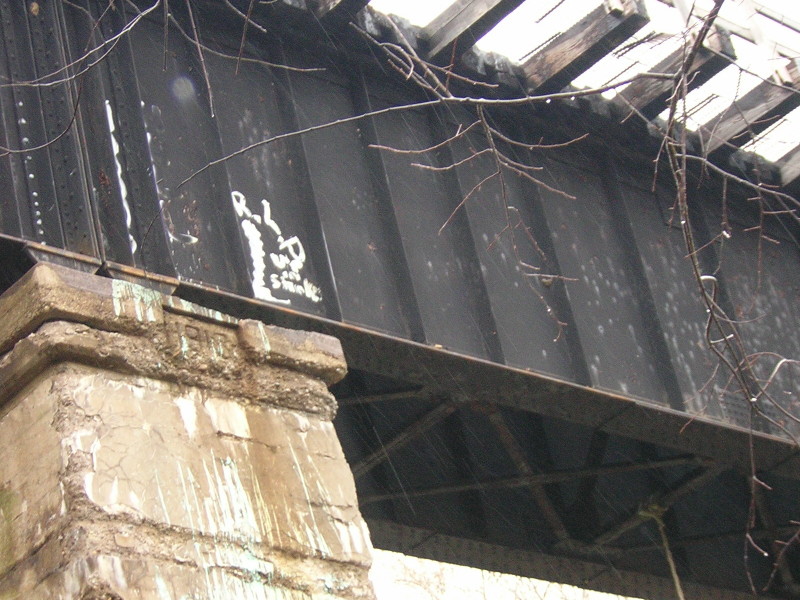
Greers Bridge. The is a truss bridge that crosses over the active
Pittsburgh and Ohio Central railroad. The deck of the bridge is very
worn but a small walkway has been placed on the deck surface I assume
to allow surveyors to gain access to the tunnel for restoration.
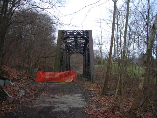
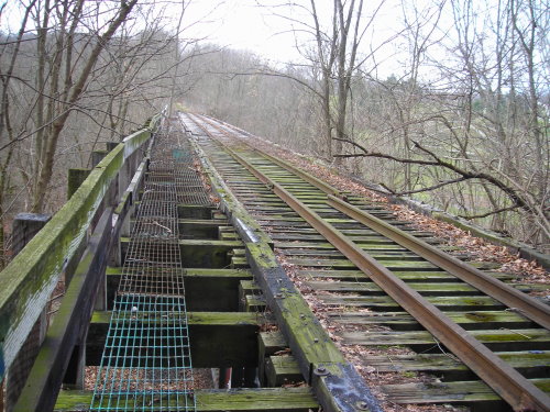
Greers Bridge
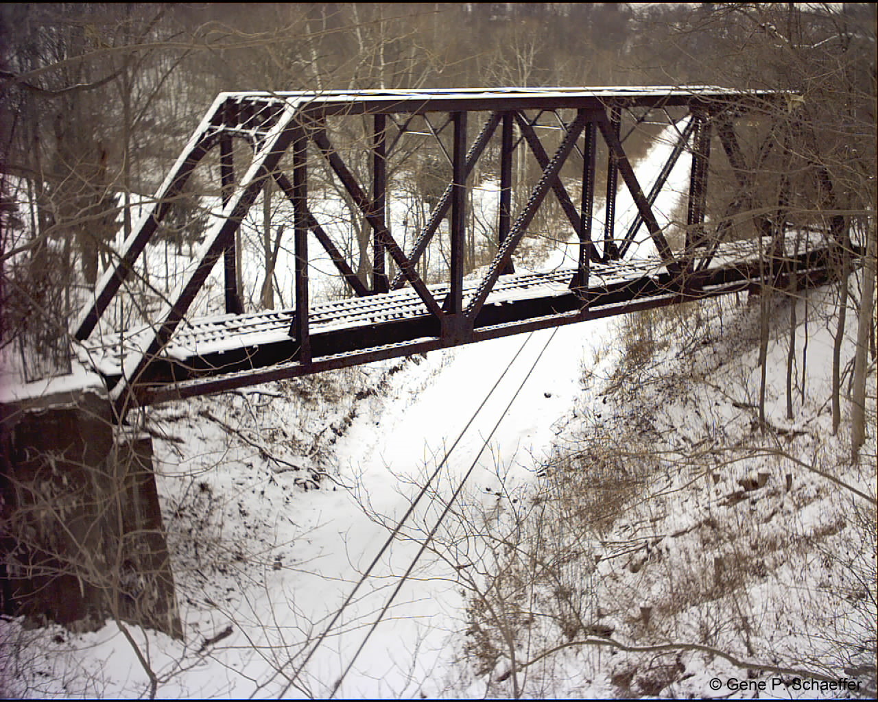
Bells Tunnel of
the P & OC Railroad can easily be seen from the bridge deck.
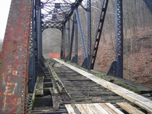
Greers Bridge deck with installed
walkway
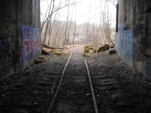
Pittsburgh & Ohio Central Bells Tunnel

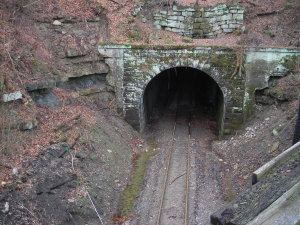
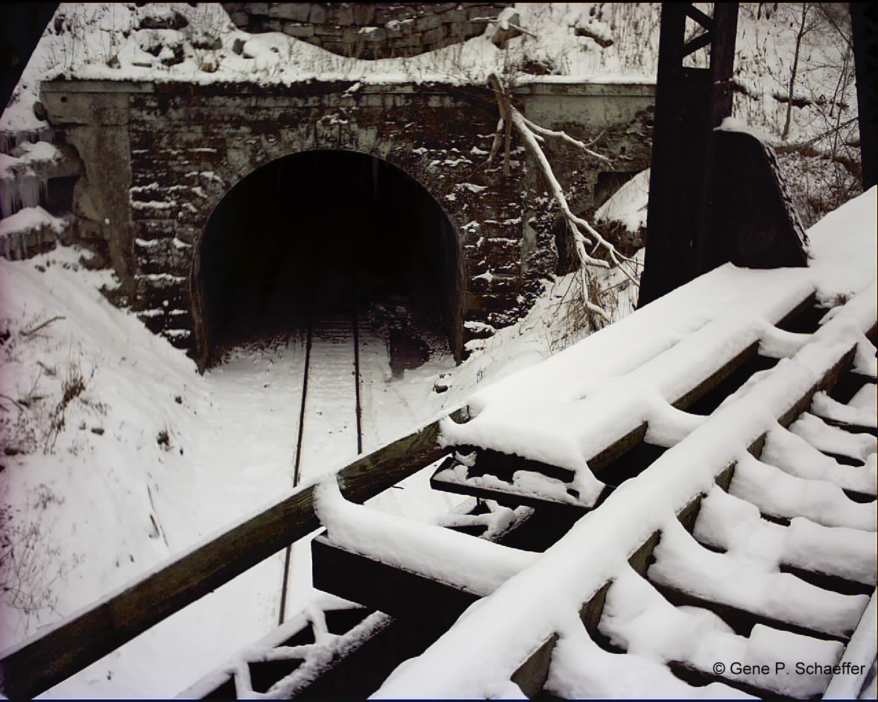
Looking from the portal to the
bridge
P&OC Bell Tunnel Portal
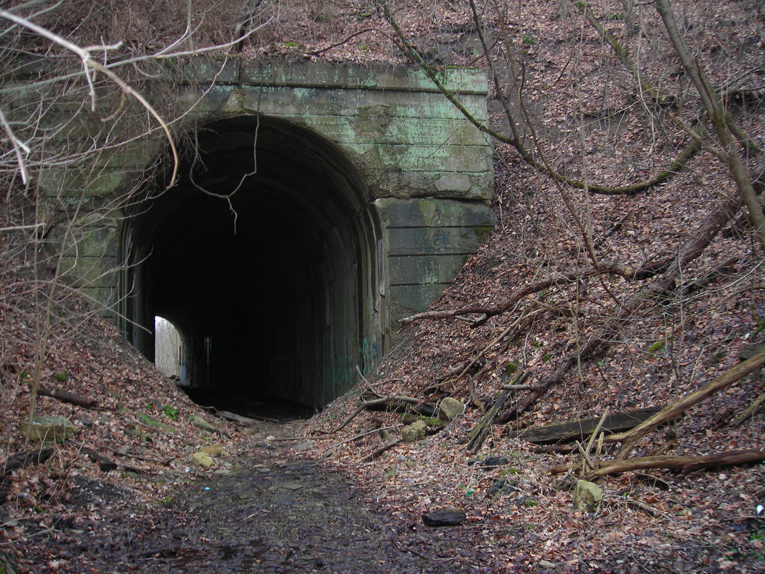
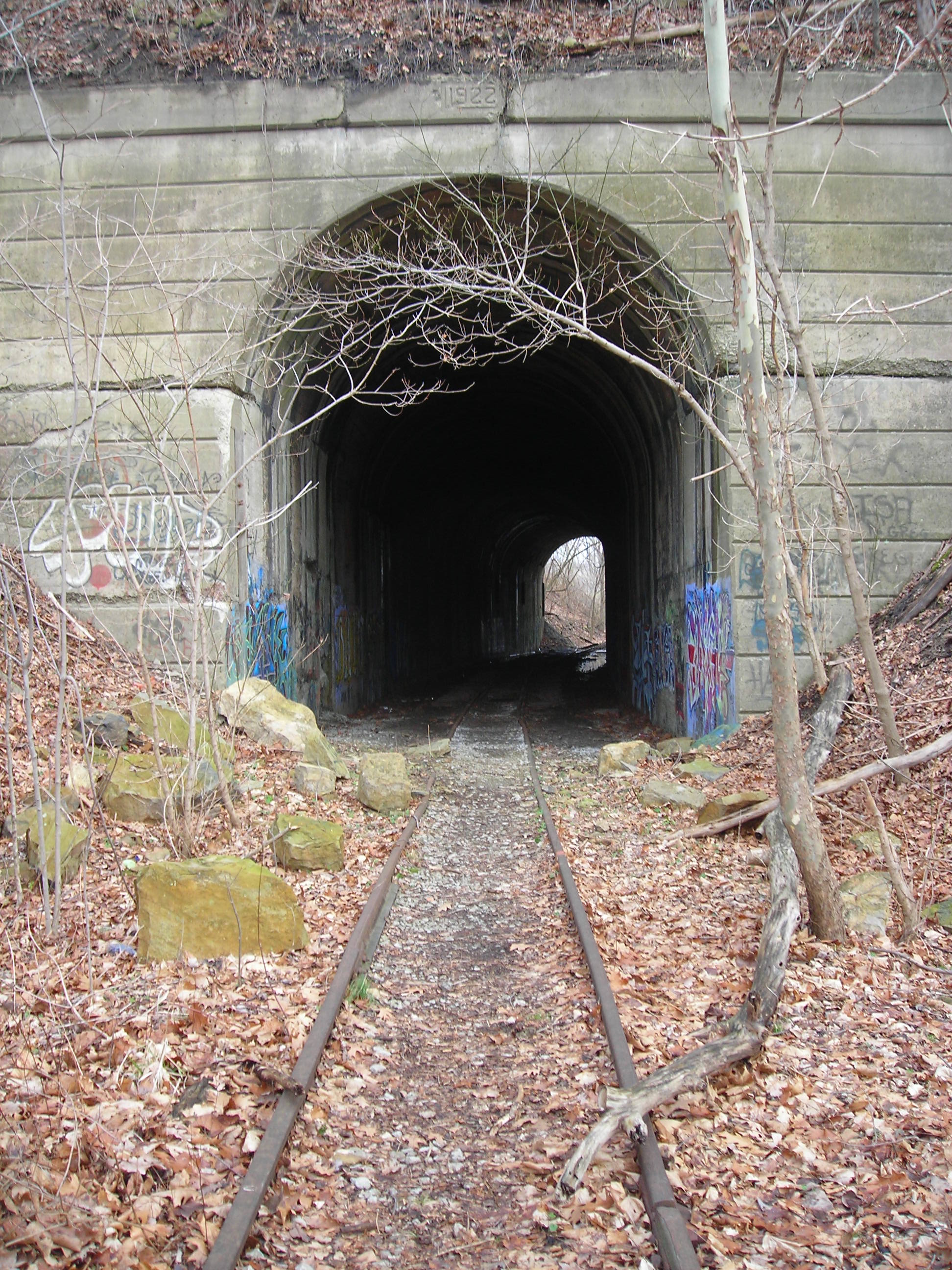
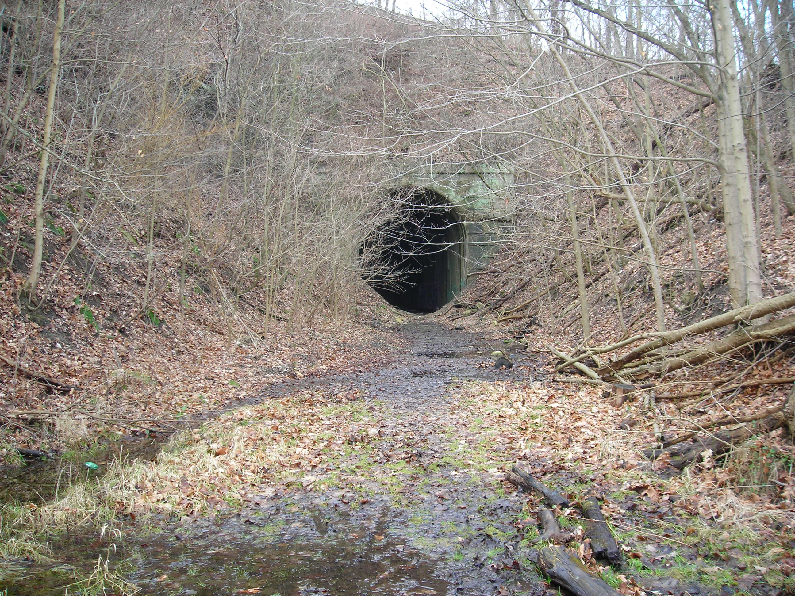
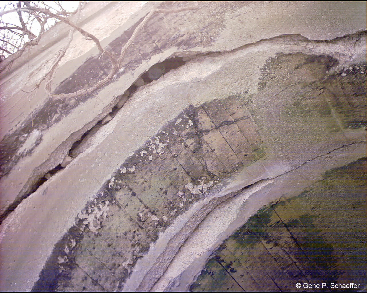
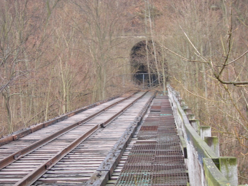
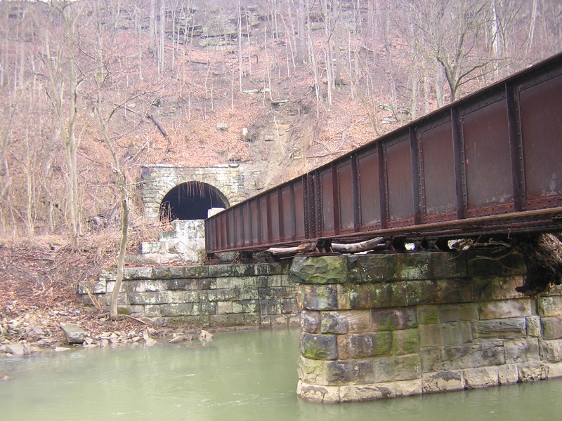
Following
crossing the bridge there is a good amount of mud before the entrance
into Greers Tunnel. The first thing you notice is how the tunnel is
slowly being buried by soil creep from the hillside. There are some
cracks in the tunnel portal that looks as if the top section of the
portal has separated from the bottom half.
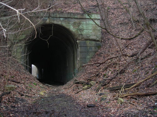
The North portal of Greers tunnel, notice the soil
creep.
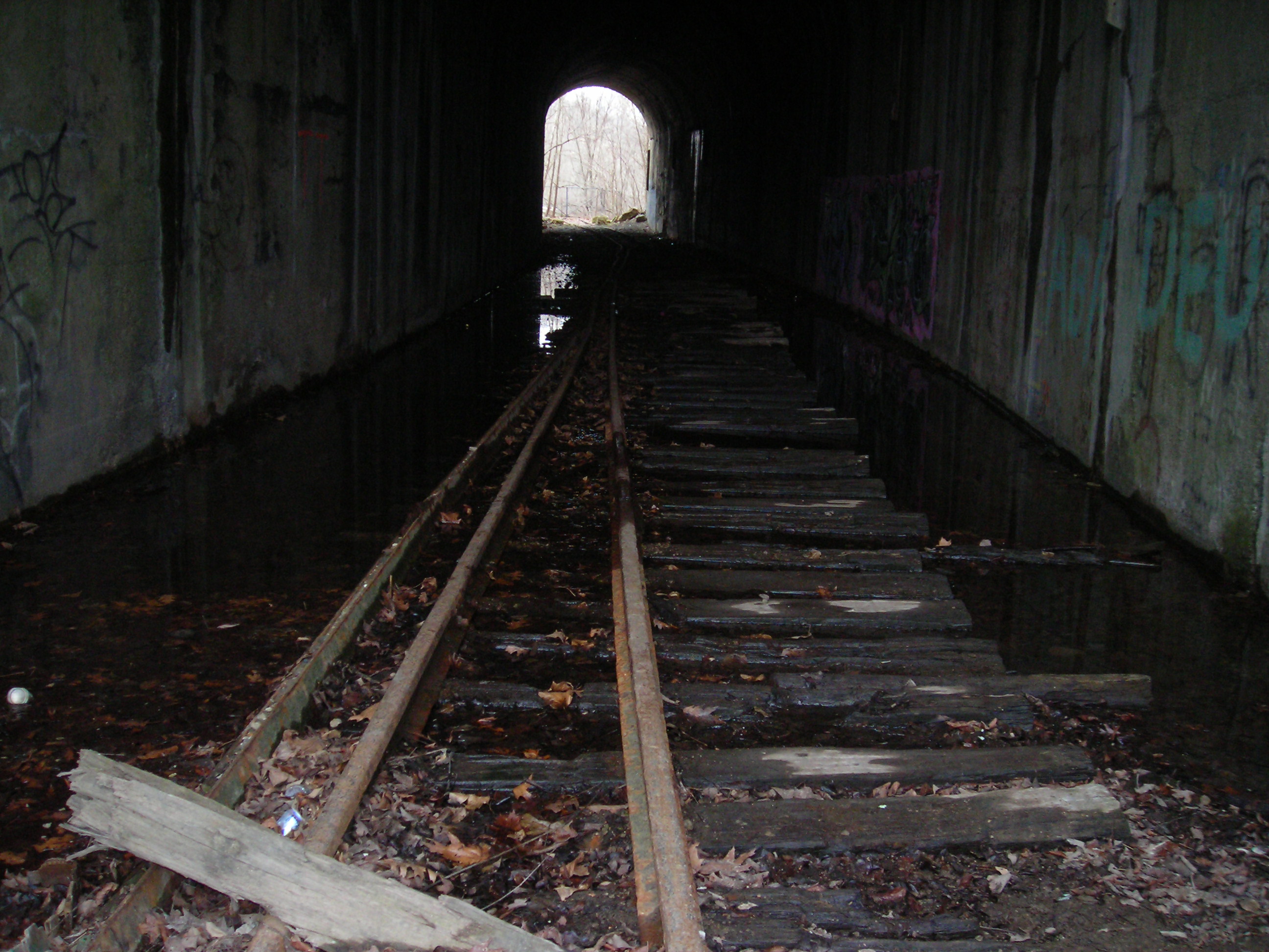
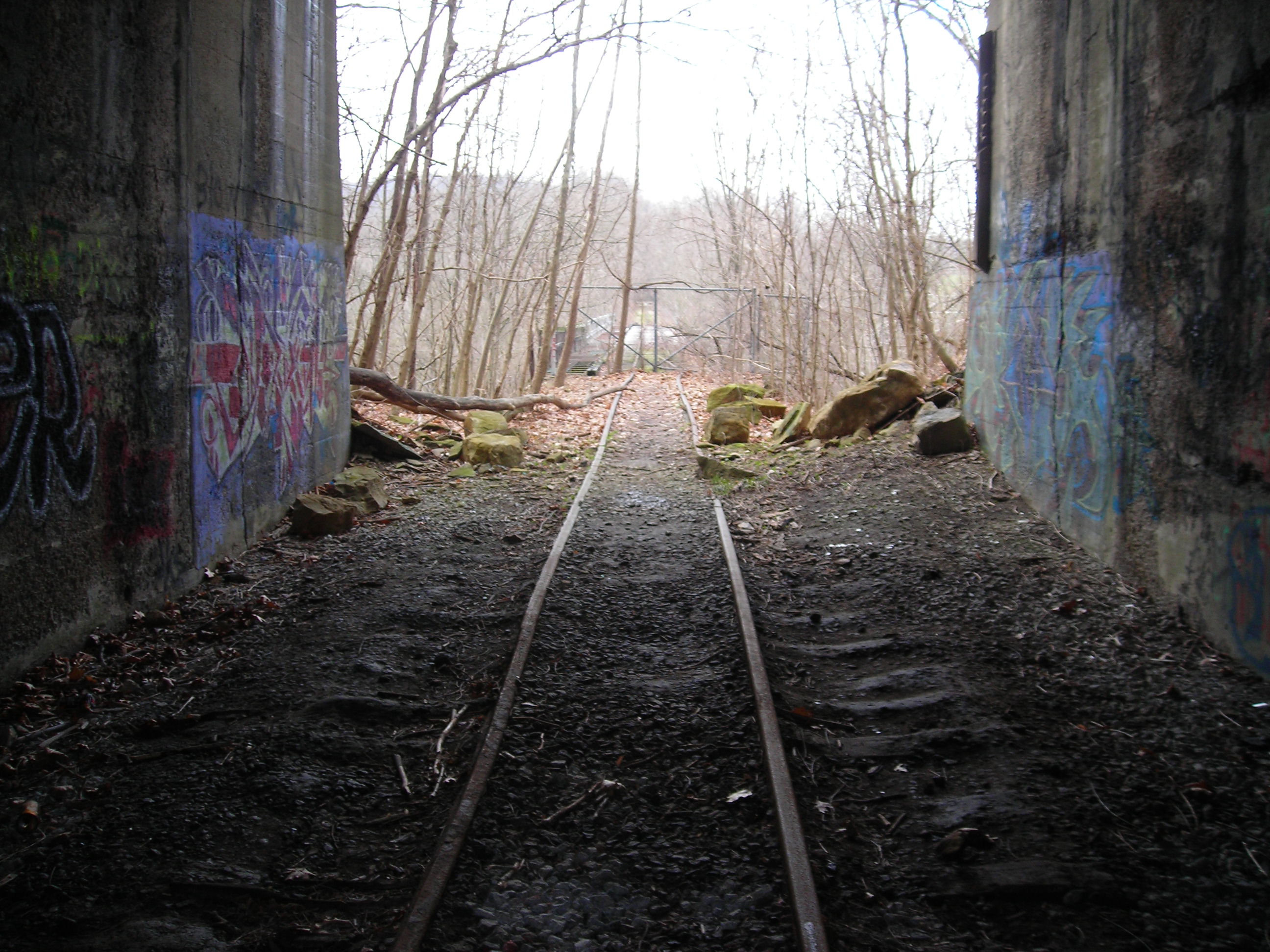
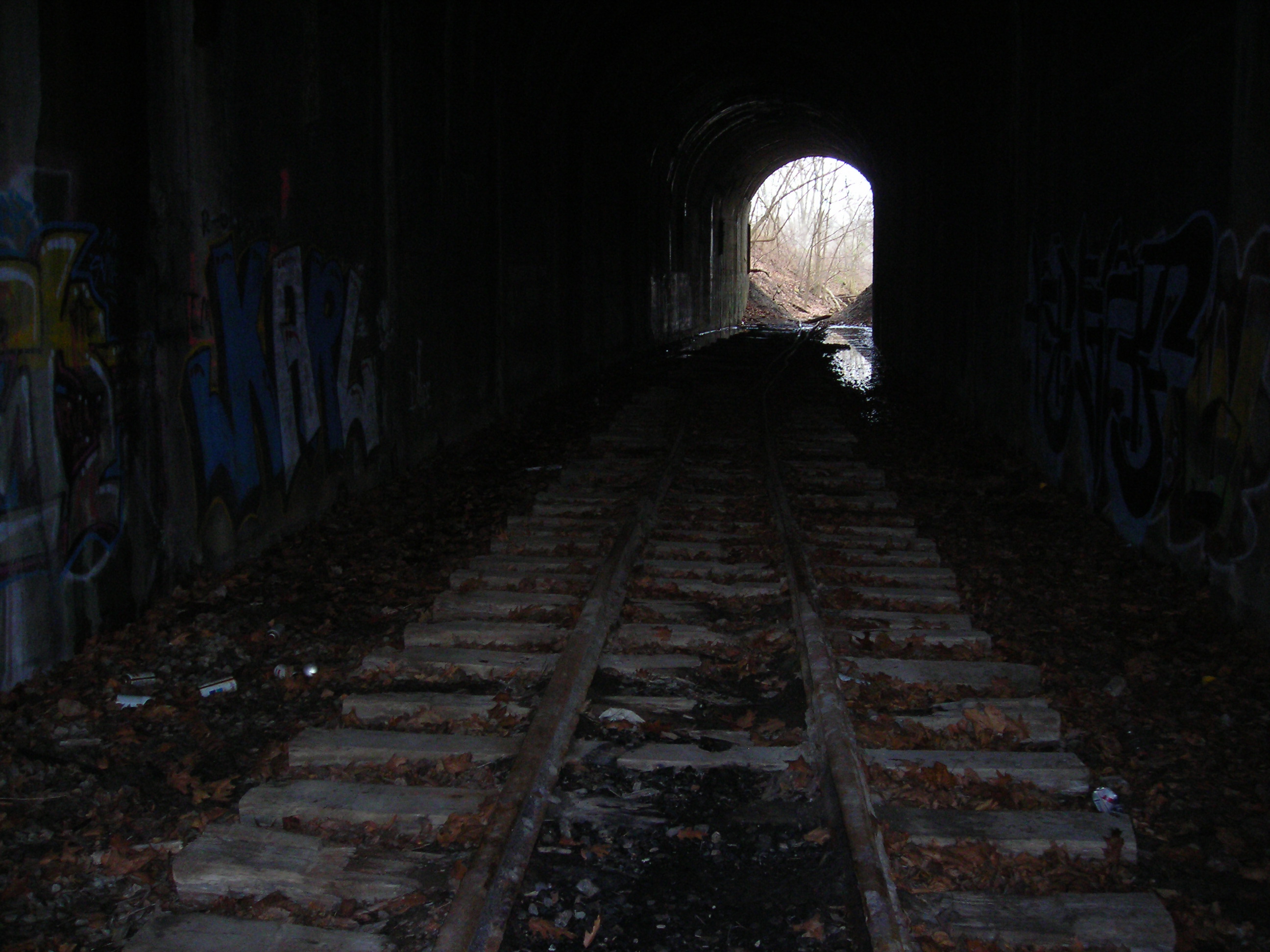
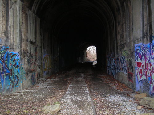
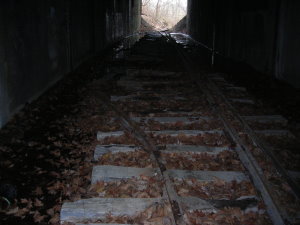
When you enter
the tunnel the first things you notice is the amount of water pooled in
the bottom of the tunnel. This has caused many of the remaining ties to
rot. Most are still in pretty good shape but they are not stable
underfoot. There is still some rail on the inside and looks to be frog
rails and not the main rail. The rail is twisted and bent in places.
The tunnel is shorter than I had imagined when I first viewed it from
the south side across the viaduct. The walls have graffiti as one would
expect for a dark location away from any houses.

Inside Greers Tunnel, lots of water on the floor
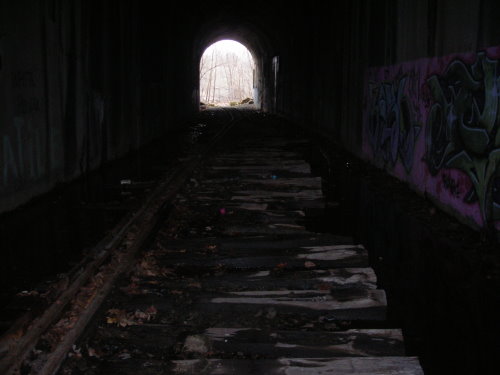
Inside Greers
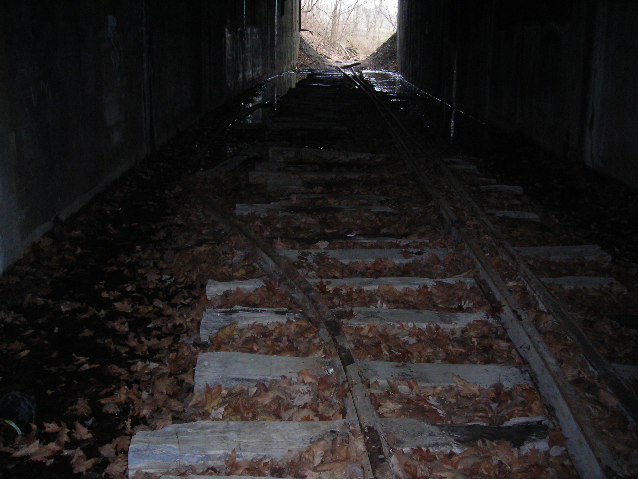
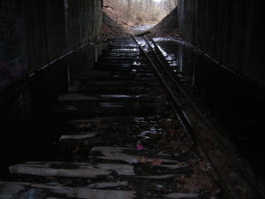
At the end of
the tunnel near the viaduct the rails become parallel again. The tunnel
floor is drier making it easier to walk, no more balancing on the ties
and rails. At the exit of the tunnel there are a number of boulders
strewn about. I am going to assume that they fell from the hillside
over the portal.
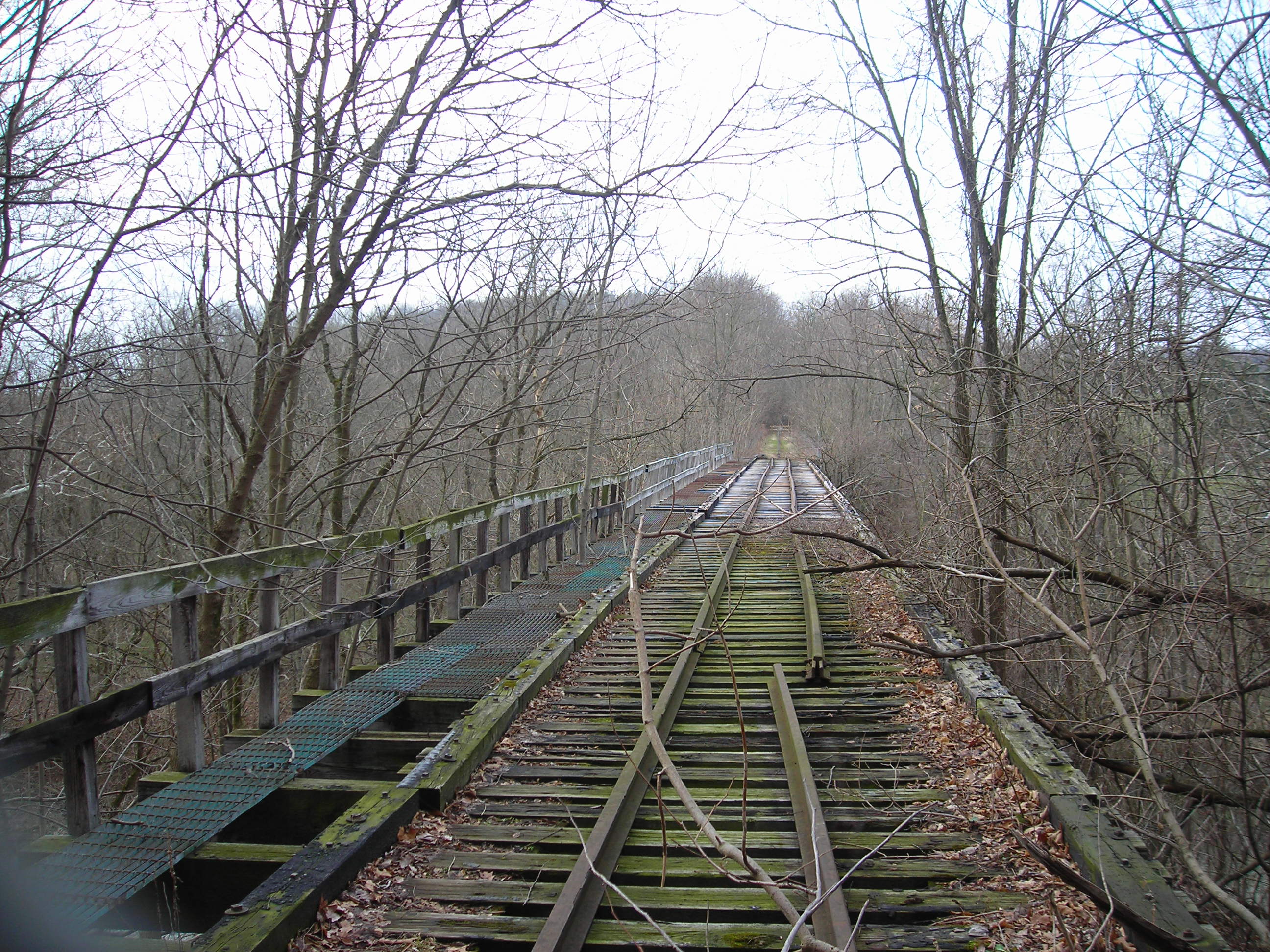
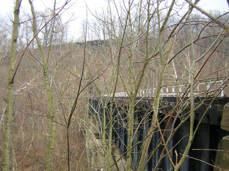
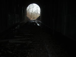
Look out towards the South and Greers Viaduct.
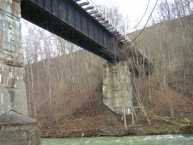
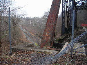
Once outside
the tunnel you of course notice the long and high Greers Viaduct that
crosses over Chartiers Creek. The viaduct is fenced off to prevent
access and for good reason. Do not go out onto the viaduct.
Greers Viaduct
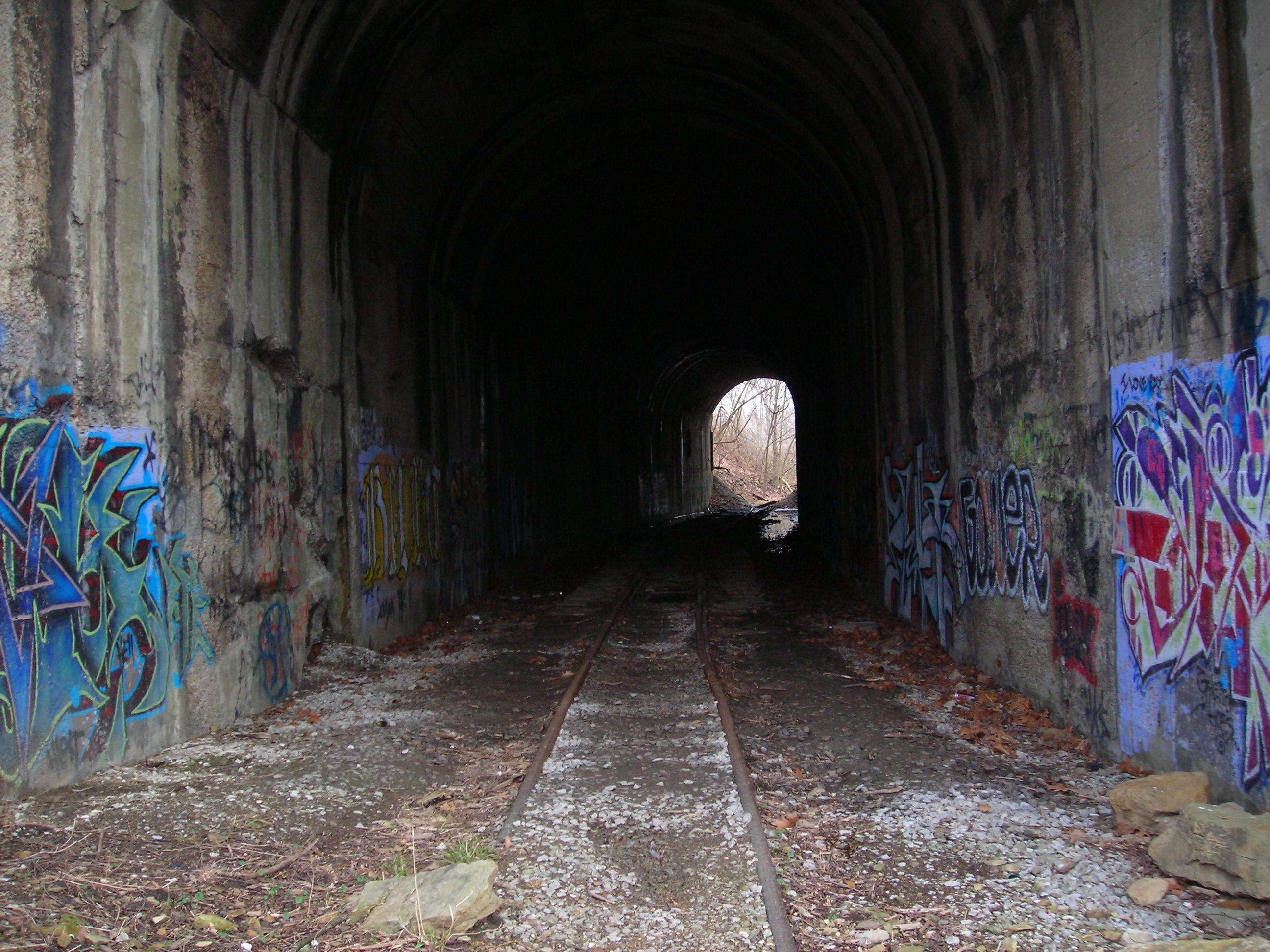
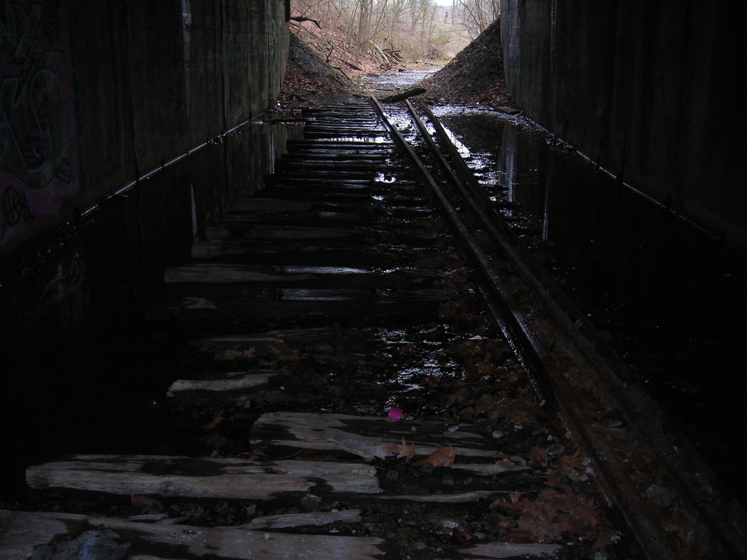
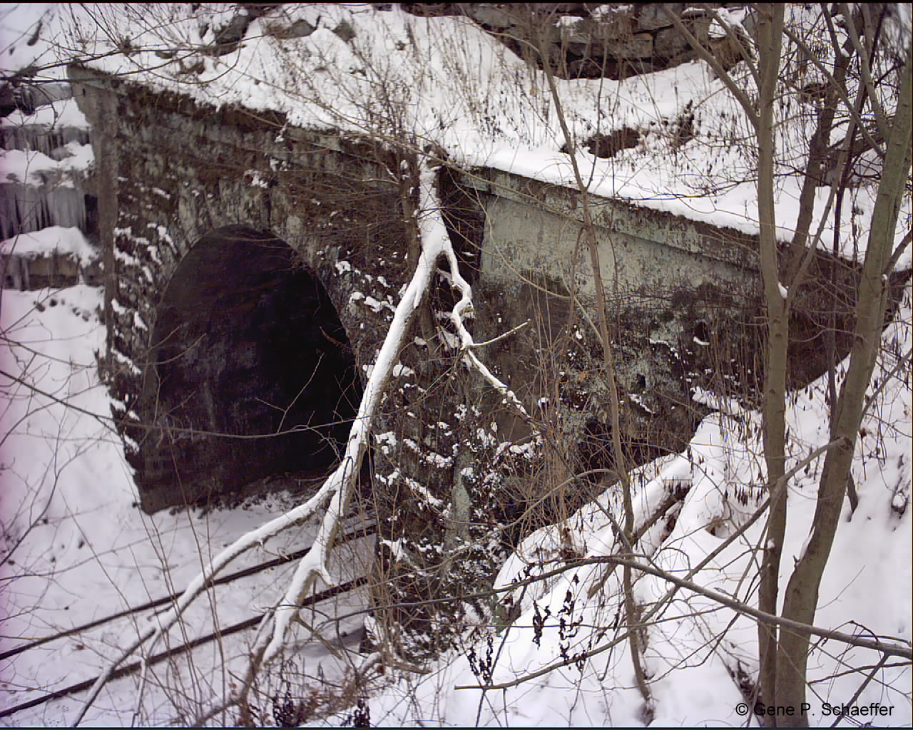
As this point
it was time to turn around and head back through the tunnel. On this
portal is the construction date of 1922. You can see the curve in the
tunnel and the exit from here. This curve is why the tunnel looks
deeper than it is from across the viaduct, you can not see from one
side to the other.
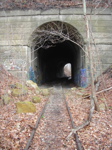
Heading back into the tunnel
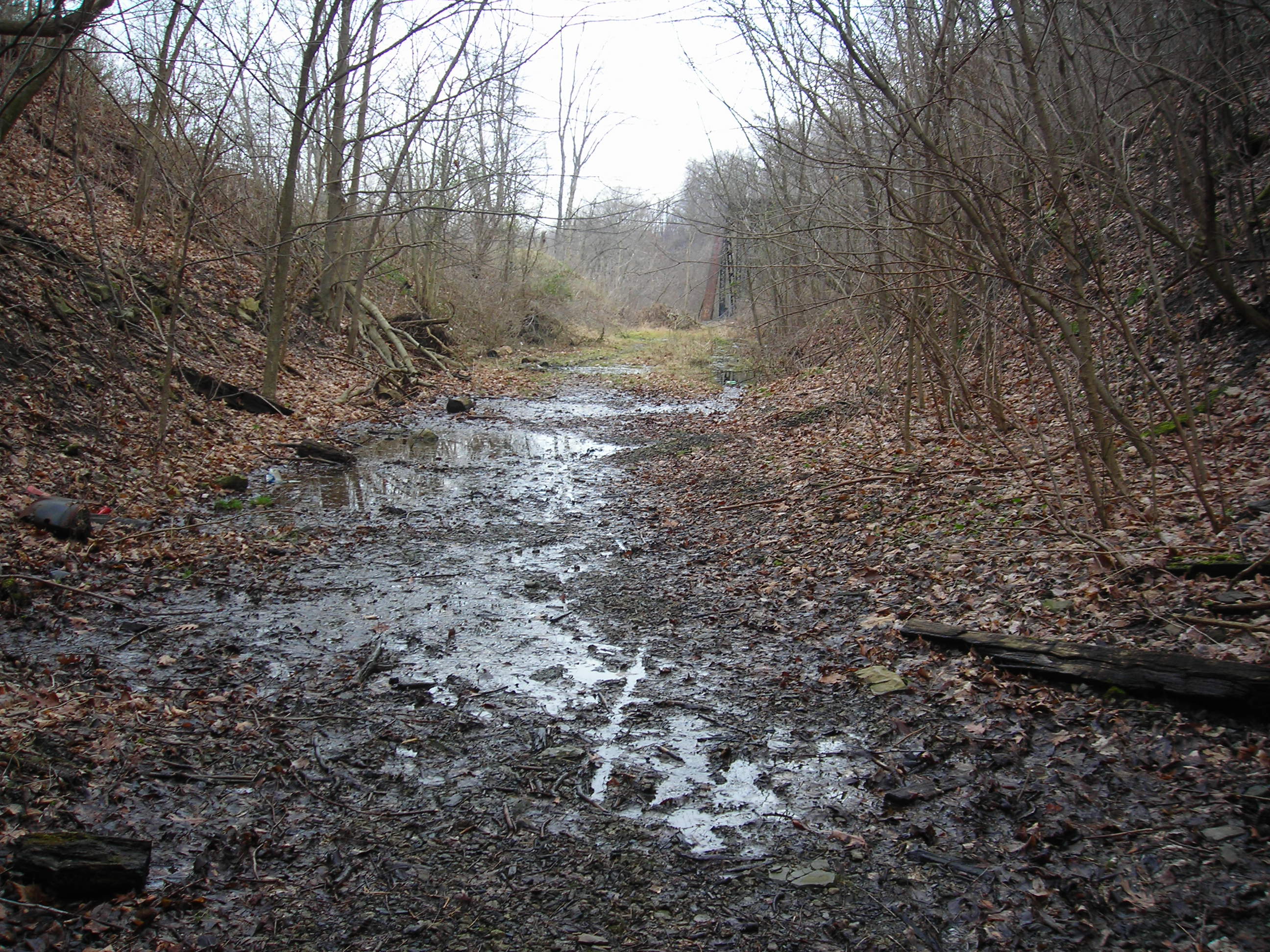
I started to
head back into the tunnel and obviously found the same conditions, dry
to mud.
Just inside the south portal.
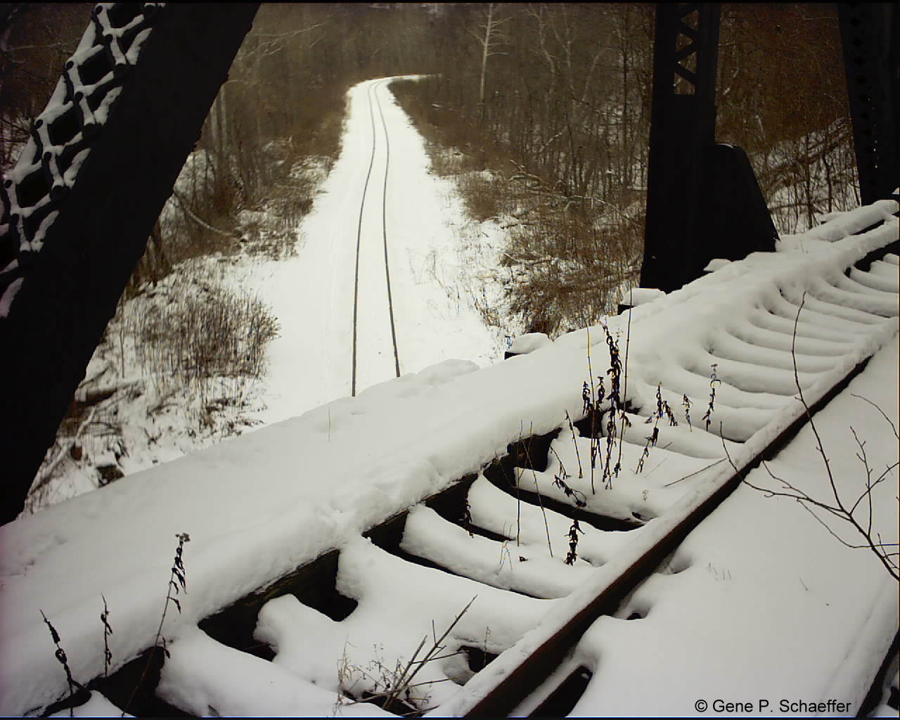
Exiting the
north portion of the tunnel reveals the bridge and the amount of mud
between the two. If your going to make the trip bring some boots. I
didn't and got some wet feet but well worth the trip.
Locking from the North portal to the bridge.
So this ends my
second journey to the Greers area. I've put some of the remaining
photos below. This is a great area for exploration, bridges, tunnels
and an active rail line make for a nice few hours exploring.


|
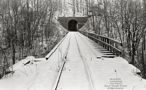
 Montour Railroad