 Montour Railroad
|
|
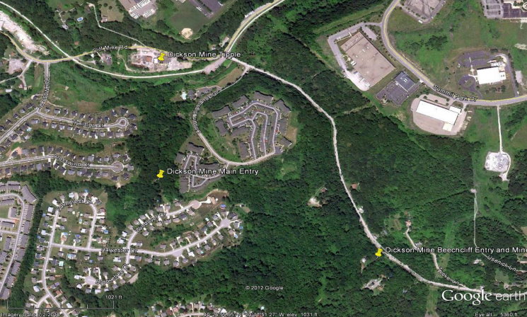
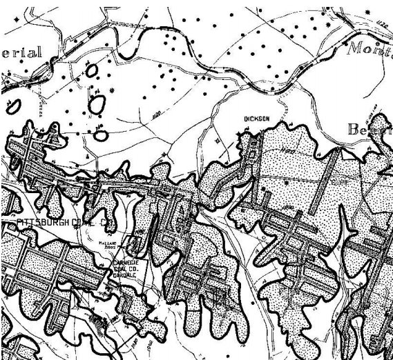
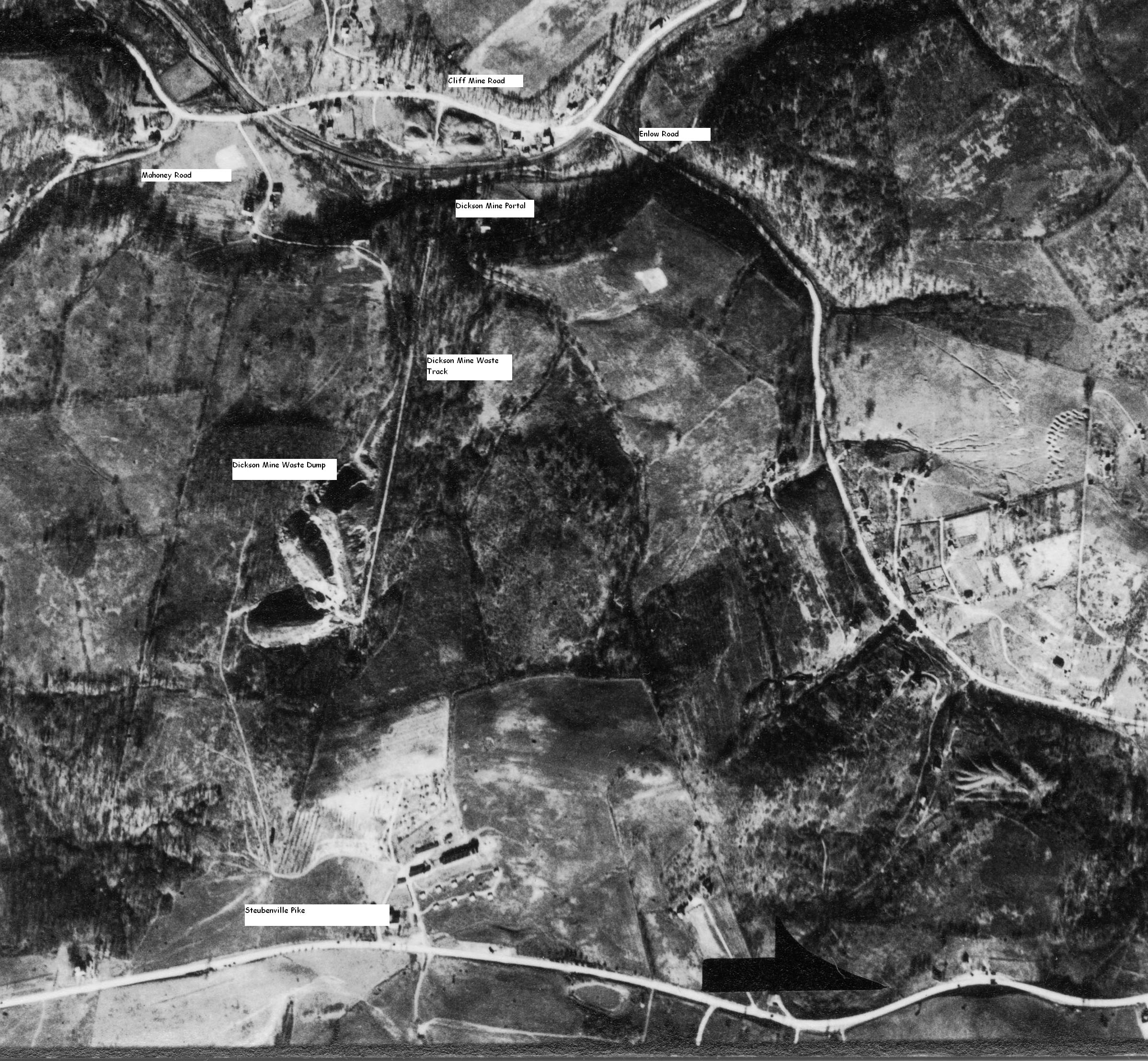
Dickson Mine Here is Bob Ciminel's report on the Dickson Mine Dickson Mine P.O. Imperial, Allegheny Co., Pa. Ship Cliff Mine, M.R.R. Seam Pittsburgh 68 in. Thick Kind of Opening Drift Daily Cap. 1500 T Preparation Equipment Picking Tables, Loading Booms & Coal Cleaners Moving eastward on the Montour Railroad, we pass Scott Siding and the B&T railroad scrapyard at Lotus, reaching Cliff Mine Siding at Milepost 6.8 (Trail Milepost 6). The history of this mine is a bit confusing, but we do know that in its last 31 years of operation it was called Dickson mine. With the startup of the Montour Railroad in 1878 the mine was called Cliff mine, but by 1881 it was referred to as Beach Cliff mine. In 1890, it was back to being called Cliff mine, but by 1898 it was the Beechcliff mine. What we do know is that there was a village called Beechcliff along Enlow Road northwest of Tucker Lane and a place called Cliff Mine at the intersection of Enlow Road and Cliff Mine on the Montour. Because the Pittsburgh coal seam was located below and north of the Steubenville Pike, one of the mine entries was located at Beechcliff and called “Cliff,” while the entry marked “Dickson” was farther west, but at the same elevation and south of where the tracks curved below Cliff Mine Road. The old tipple and sidings were located where the light industrial complex is west of the trail parking lot. There was no bony dump near the tracks because the rock, shale and slate were dumped up the hill at the mine entrance in an area now covered with subdivisions and apartments. Coal was brought down the hill on an inclined plane about 200 feet long. Dickson was a large mine and extended underneath Steubenville Pike to the southwest and southeast until it reached the boundary line where it abutted Carnegie Coal Company’s Oakdale mine. When the workings were begun in the late 1800s, the coal was being mined “up dip” and water naturally drained to the north out of the mine and into Montour Run. After passing beneath Steubenville Pike, the coal seam dipped to the southwest and water collected in the back of the mine, creating what the miners called “swamps.” Dickson eventually dug a drain at the southern end of the mine and let the water run into one of the streams south of Steubenville Pike. Opened in 1878 by the Imperial Coal Company, Dickson mine had several different names and operated for about 50 years. It was the reason that Cliff Mine Siding existed. Thanks to the excellent web site created by Ray Washlaski at http://patheoldminer.rootsweb.ancestry.com/, we have some records from Dickson mine. J.E. Crouch was listed as Superintendent in 1900, followed by F. B. Dunbar in 1904 and W. M. Garrett in 1917. The General Superintendents were W. W. Keefer from 1903 to 1905 and J. M. Armstrong as GS in 1917. Some sad injuries were also reported: Charles Hampson, age 14, lost an arm in a slate fall in 1900 and Clarence Cole, a 17-year-old, fractured an arm in 1916. The following images provide both current and historical views of Dickson mine. This Google Earth image shows the locations of Cliff Mine and Dickson mine as they exist today
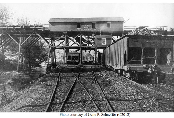
This is a photo of the Dickson mine tipple looking toward Imperial.
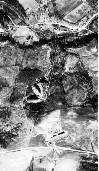
Below is an aerial view of the Dickson mine taken in the late 1930s. The bony dump and incline plane are visible at center left, with the tipple near the top of the photo. The community of Beechcliff is on the right, with Steubenville Pike running from left to right across the bottom. If you look closely, there is a trestle exiting the hill south of the Pikewhere the mine continued to the southwest. (Two photos courtesy of the Penn Pilot web site).
This is a close up from the previous photo showing the mine and tipple in better detail
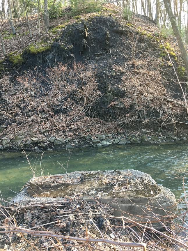
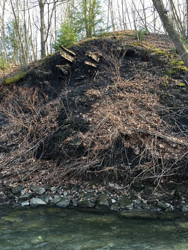
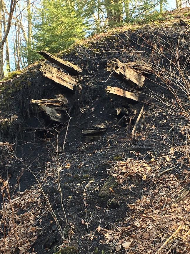
Looking now across Montour Run at the far bank -
there are several timbers sticking out of the hillside. They are about
the right height to be the mine railroad that goes into the top of the
tipple.
|
|||||||||||||||||||