Henderson
No 1. Mine
Read Bob Ciminel's report on the Henderson No 1 Mine.
The
1940 Montour timetable shows Henderson Siding at MP 27.79 with a
capacity of 65 cars. I believe this was the former National
Siding that was renamed after National No. 2 closed down.
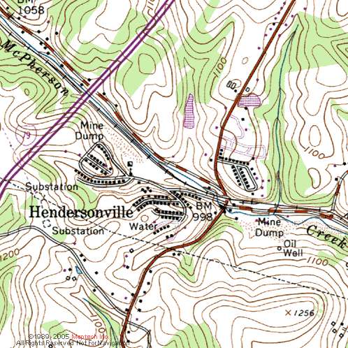
Hendersonville station was listed at MP 28.22, not quite a half-mile
east of the siding.
Henderson Siding was station 124 and
had a derail on the east end. Henderson Mine was station 125 with
a west end connection off of the siding and an east end connection off
of the empty yard. Another east end connection was made off of
tracks 1 & 2 from the loaded yard. These two east end
connections to the main track may have served as a runaround track
because there doesn't appear to be one at the tipple. Station 126
was the Hendersonville Commercial Spur with an east end connection off
of the main track. The spur held 6 cars and probably served the
company store among other things. Train crews were cautioned that
it was not safe for locomotives to go beyond the mine's supply track
switch and the supply track was only safe for engines up to the
unloading pit.
The 1947 timetable only shows stations 124
for the Henderson Siding and 126 for the Commercial Spur. The
mine is not listed in the timetable, suggesting that it was either
closed or abandoned.
Henderson is listed in the 1977 timetable but the siding is not listed. Bob Ciminel
The Henderson Mine had an
interesting setup. The mine was west of the point where the
southeasterly trending Cross Creek Syncline abruptly ended at the
Nineveh Syncline, which trended northeast. The coal seam ranged from
760' MSL at the southeastern end of the mine to 800' MSL at the western
edge of the workings. The mine was down in the valley of McPherson
Creek, at around 1,000' MSL, which kept the workings fairly shallow
(about 240' at the tipple).
 Henderson
No. 1 Mine was opened in 1914 at McPherson's Mill
(Hendersonville) and coincided with the completion of
the Mifflin Extension of the Montour Railroad. The mining
camp, built by the Henderson Coal Company to provide housing for the
miners, was named Hendersonville in honor of Mr. William Henderson, an
official of the company. The mine was eventually
purchased by the Pittsburgh Coal Company and operated into the 1950s.
Henderson
No. 1 Mine was opened in 1914 at McPherson's Mill
(Hendersonville) and coincided with the completion of
the Mifflin Extension of the Montour Railroad. The mining
camp, built by the Henderson Coal Company to provide housing for the
miners, was named Hendersonville in honor of Mr. William Henderson, an
official of the company. The mine was eventually
purchased by the Pittsburgh Coal Company and operated into the 1950s.
At 6:20 a.m. on March 13, 1917, the Henderson mine was rocked by a
methane/coal dust explosion that resulted in the deaths of 14
miners. The explosion was attributed to a build up of methane
gas that resulted when ventilation doors were left open during the
morning shift change. The gas was ignited by an
electrically-powered mining machine, a new technology in use
at some newer mines in the Pittsburgh area.
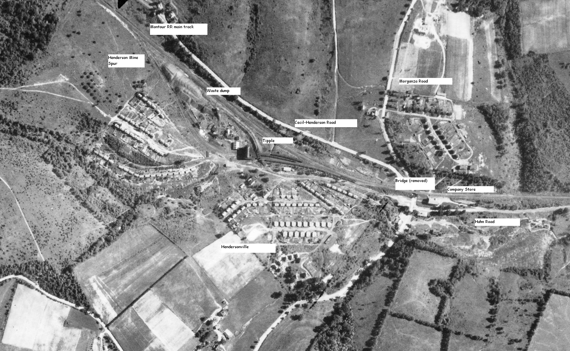
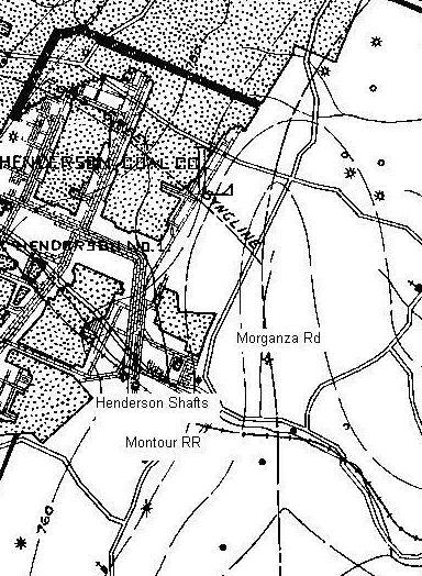
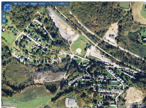
The mine site and village are located northeast of the Southpointe exit
on I-79 at the intersections of Morganza Road and
Georgetown/Cecil Henderson Road. The tipple was northeast of
Henderson Drive and south of the Montour Trail.

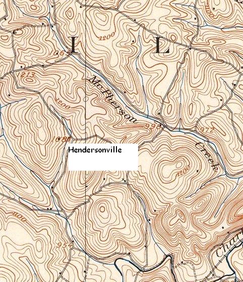
Below is a map of the Henderson
Mine. Marked are the locations
of the Montour RR, the two shafts into the mine (the coal seam was at
760 feet
above sea level here), and Morganza Road. Ground elevation at
the
intersection of Morganza Road and Georgetown Road is 998 feet above sea
level,
so the mine was around 230 feet deep.
More pictures of the Henderson Mine
can be found here.
 Montour Railroad