 Montour Railroad
|
|
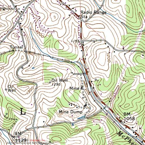
National No. 2 Read Bob Ciminel's report on the National No. 2 Mine. Unfortunately, there is very little information available on National No. 2. It is not listed as a station in the 1940 timetable, nor any of the other timetables I have. The 1917 Pennsylvania Bureau of Mines report states that a new shaft was put down at National No. 2 on the Montour Railroad, and the 1925 list of passenger stations shows National station at Milepost 27.21, although no passenger trains operated that far east in 1925. National No. 2 Mine was operating as early as 1905, probably accessed via the National No. 1 entries. After the Mifflin Extension was completed in 1914 they probably built the new tipple and began shipping via the Montour. Clearly another case of the Montour stealing business from the PRR. Coal depth at No. 2 was around 800 feet MSL, and the ground surface was around 1,120, so it was a fairly deep mine when compare with the surrounding mines. - Bob Ciminel
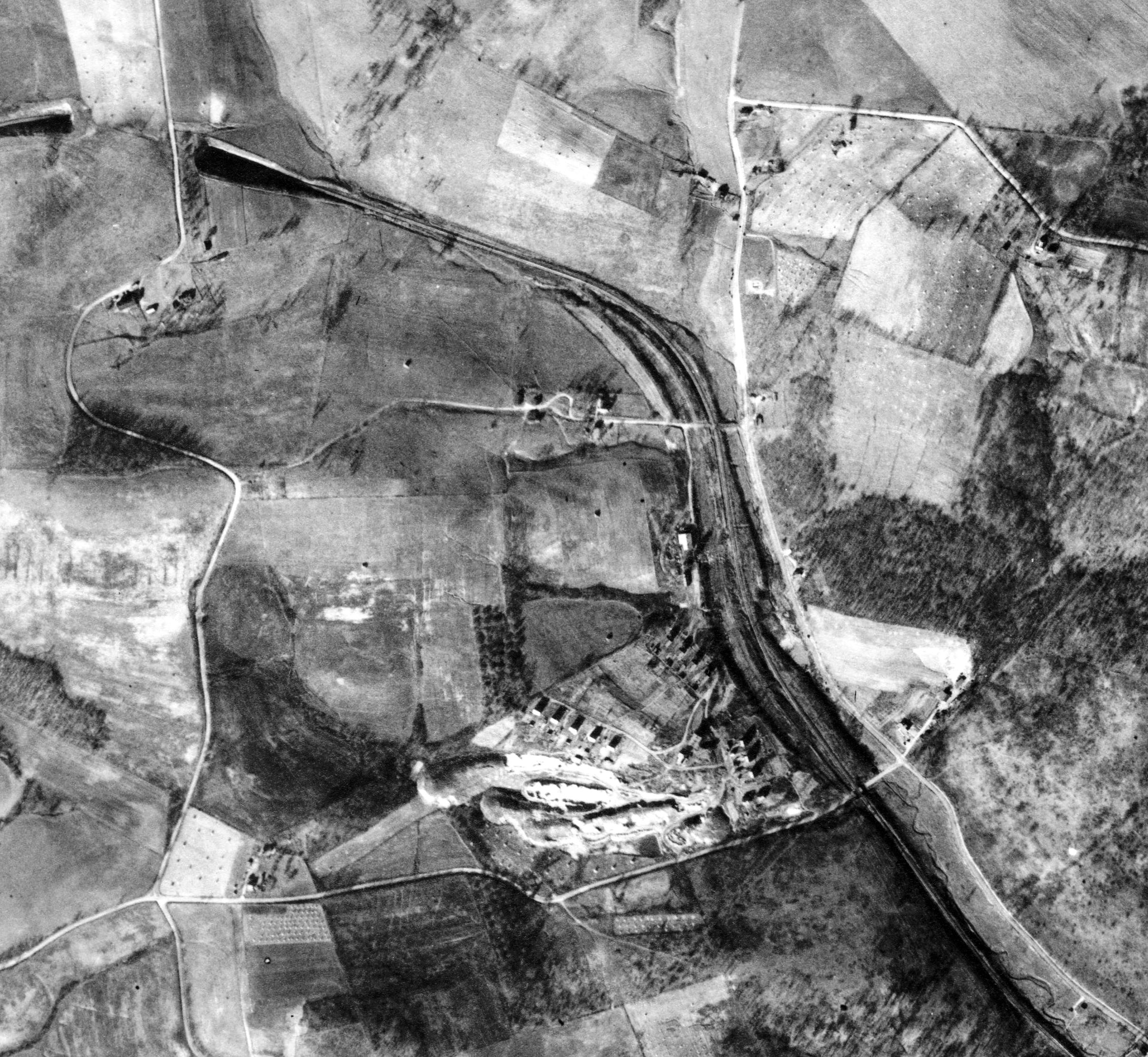
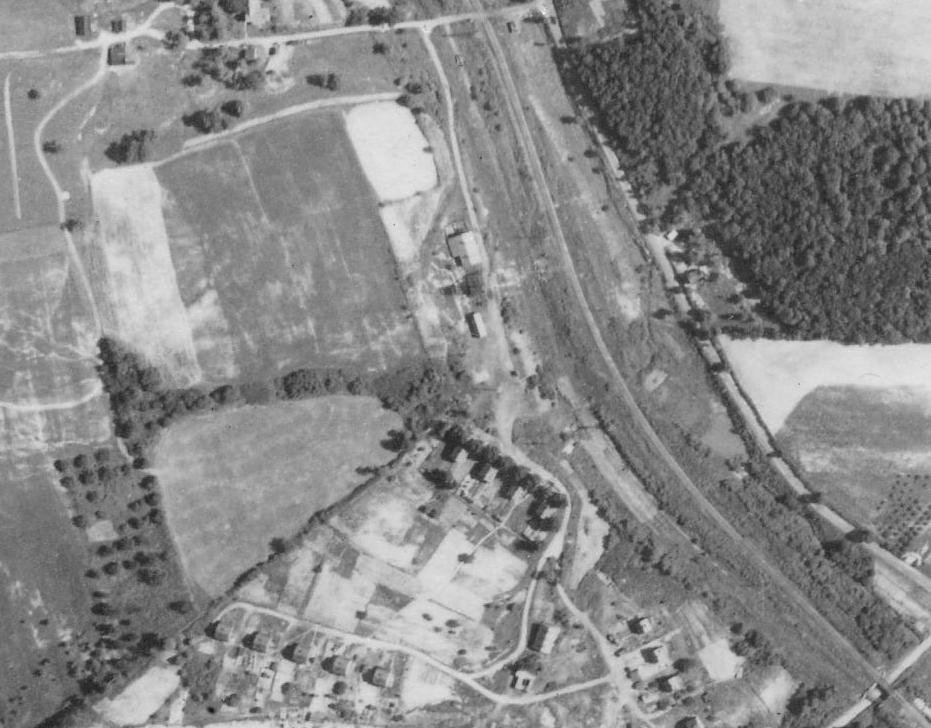
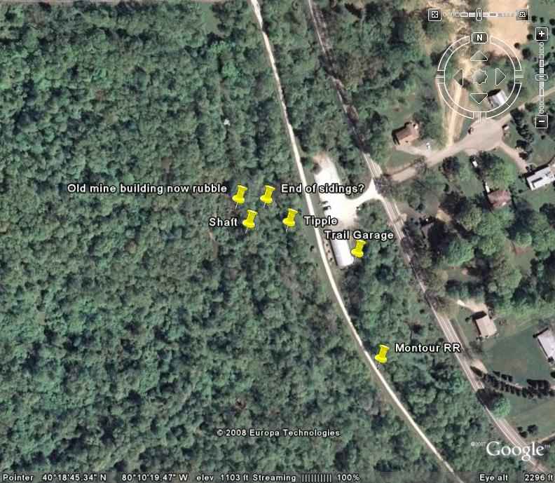
I stopped by National #2 this afternoon & took a look at the concrete bases. 3 bolts in each one - about 1 inch thick bolts. I am doubting a water tower - no sign of a base for center column to get water into a tower. Plus it is too far off the Montour main line - at least 50 feet - to service engines there. With the concrete wall at the SW side which was where the tracks went to the #2 tipple - I am guessing it was something to do with the mine. On the photo above from 1939 - there is nothing that stands out in that area. At the top center of the picture is Tar Heights Road - National Crossing. Bottom Right is Papp Road bridge. Center of picture are a couple of buildings with light roofs & a road going into the bigger one. Perhaps the main mine building? Between them is a darker structure - the shadow suggests it could be the head of a hoist house which could be where the shaft was located.
Exploration by Dennis Simms
After a walk on the Montour Mainline between National and the National
Tunnel, I decided to do a little "Mon-Touring" around some of the
remains of #2. The remains are relatively easy to get to, as the
roadway than connected them to Papp Road is still an easy walk. Once
there, I found the remains of three structures. A brick building with
structural steel, a concrete foundation and a building built out of
terra-cotta tile block. Its easy to get to the remains, but getting up
close and personal is a chore as they are now heavily guarded by
blackberry and multi-flora rose. Wearing fleece sweat pants was not a
good choice for this Mon-tour.
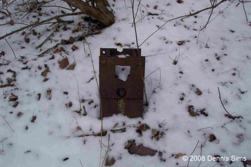
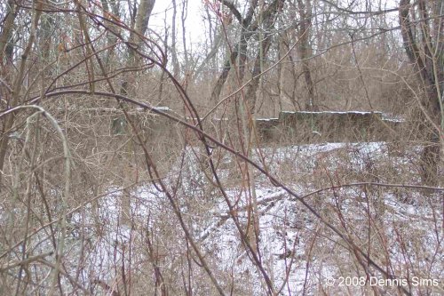
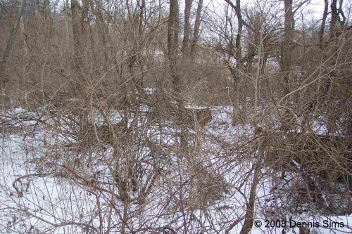
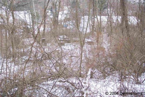
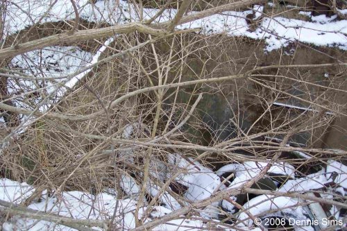
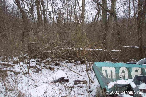
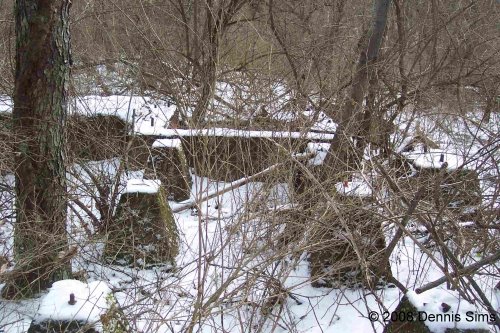
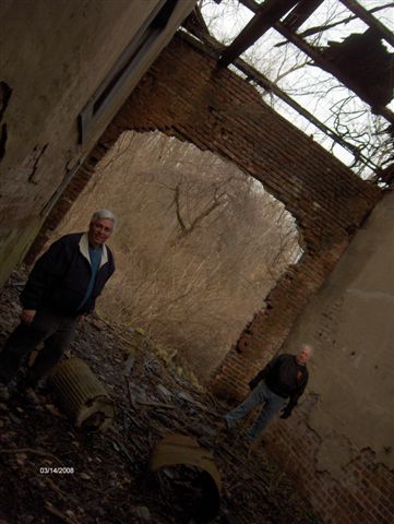
The walls of the large brick building were still intact a few years ago, but a logging operation took place to harvest numerous wild cherry trees that risen from the mine site, apparently knocked those walls down. The pictures are not great, as I only had my cell phone camera, but I am heading back soon with a better camera and better wearing apparel. The remains of this building are visible from the Trail by the bulletin board at the Kurnick (National) Access Area. 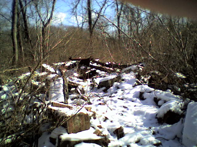 A concrete foundation, that could have been the shaft, now filled with household junk. The whole area appears to be a local junk yard with household appliances strewn about. 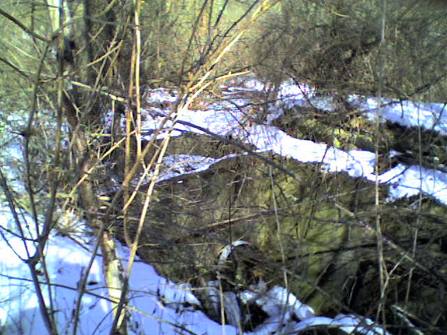 The terra cotta tile block building with some of the junk. 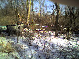 Proceeded back down the hill and walked around the yard area and found this sticking out of the ground. In fact, there were two of them. I wonder if these could have been bumper stops for the end of the siding?? The base for a tipple? 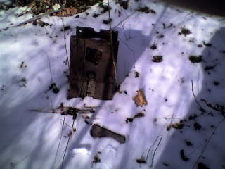 This was only a scouting trip. Will head back on a day without snow cover, a better camera, and better clothing before things start leafing out in a few weeks. Second Trip Plunging into the woods behind the unsheltered picnic table, I quickly located the two bumpers. I had found on the previous visit. There is a light coating of snow on the ground which increased the contrast making it easy to find them. Turned left found the concrete wall at the top of hill, continued my counterclockwise turn and lo and behold, there is the remains of the tipple. No more than 10 feet behind the tree line along the trail. I have been by there for 15 years and either there was too much foliage to see the concrete footers or I thought it was snow on fallen trees. These concrete structures line up with the concrete wall on the hill and behind that concrete wall is what I think is the shaft for the mine, now filled with household junk. So I walk up the hill to get a better view. In the background you can see the Trail garage and the port-a-john in the parking area for reference. Behind me is the concrete wall which is pictured below. Behind this concrete wall is I believe the shaft filled with tires, dishwashers, refrigerators, etc. Cut across the top of the hill to the old mine roadway, now an ATV path and visited the remains of one of the mine buildings. Anybody remember when marvel ice cream was last sold around here or delivered by truck? After returning to the parking area, I plunged back into the woods, now knowing where my find was and took a couple of close ups of the more intriguing concrete structures. The sidings would be to the right.
Thanks
for the photos Dennis, not much left anymore. There was one building
left in the mid 70's, rather large shop type structure. Wood and tin
construction, definitely a mine building.
This morning three explorers battled multiflora rose thorns and checked
out the ruins of Montour #2, which is located off of Cecil-Henderson
Road, directly behind the trail garage . . . this old building was
still standing (unlike Grampaw Carter).
We found the old tipple and what we think were the loading yards plus
lots of old garbage, a nice three story house that still has a few
chimneys standing and some other interesting pieces of concrete and
debris from the past, including a "Marvel" electric sign. - Troy
Bogdan
|