 Montour
Railroad
Montour
Railroad
|
|
|
| MP 12 Matchett Farm
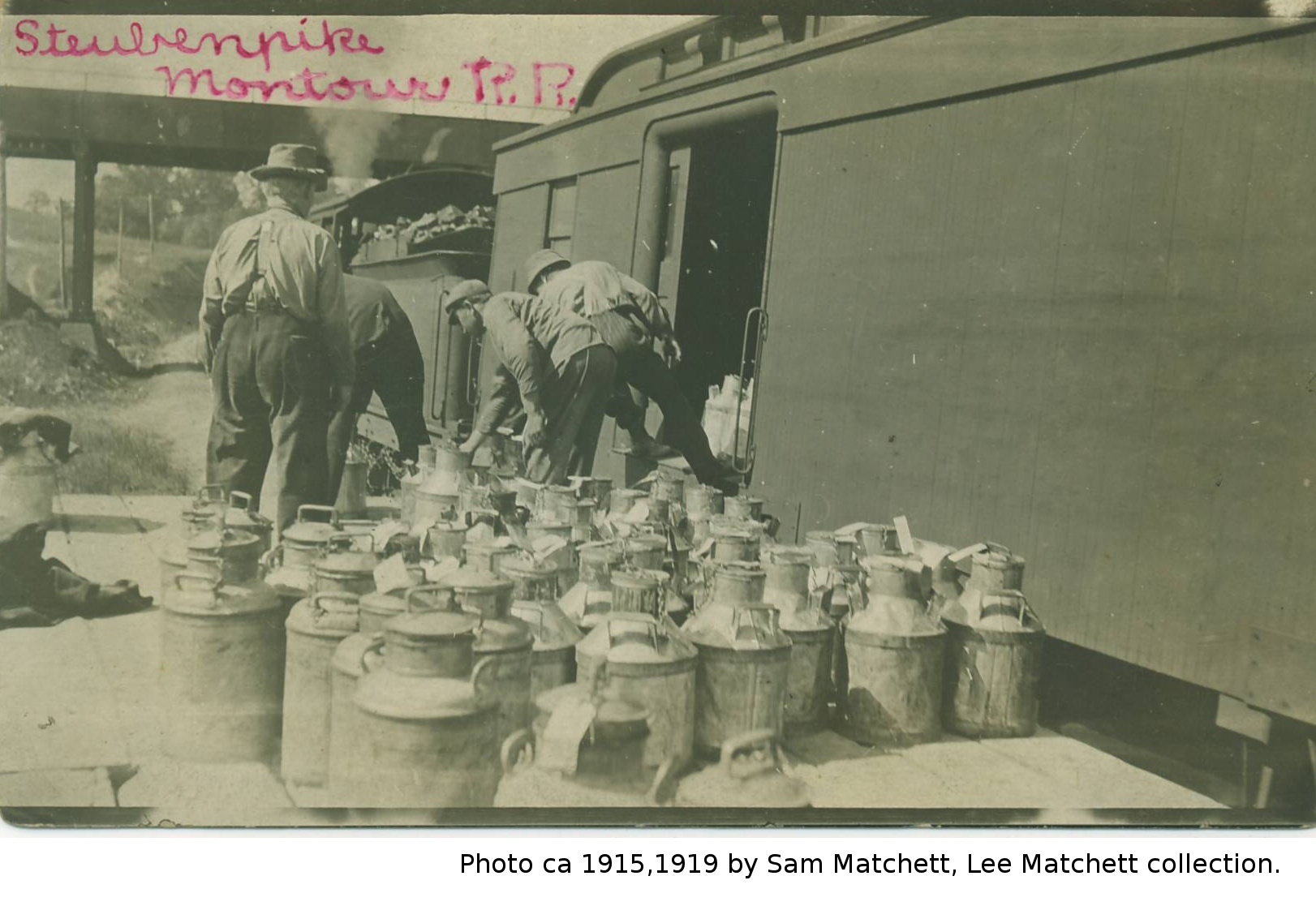
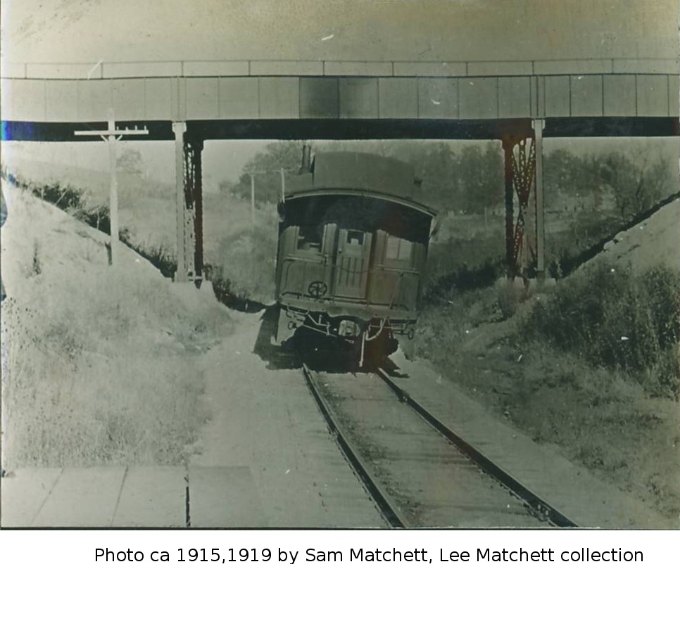
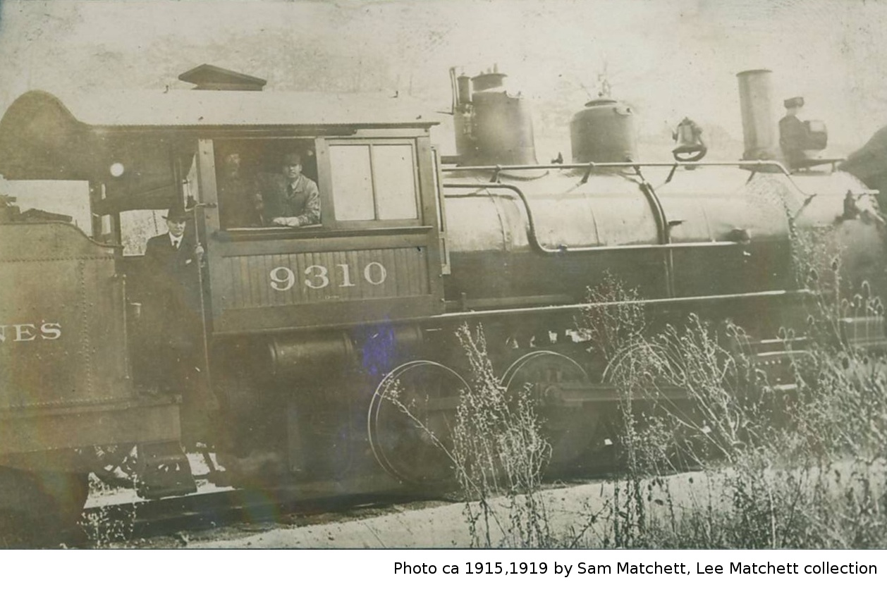
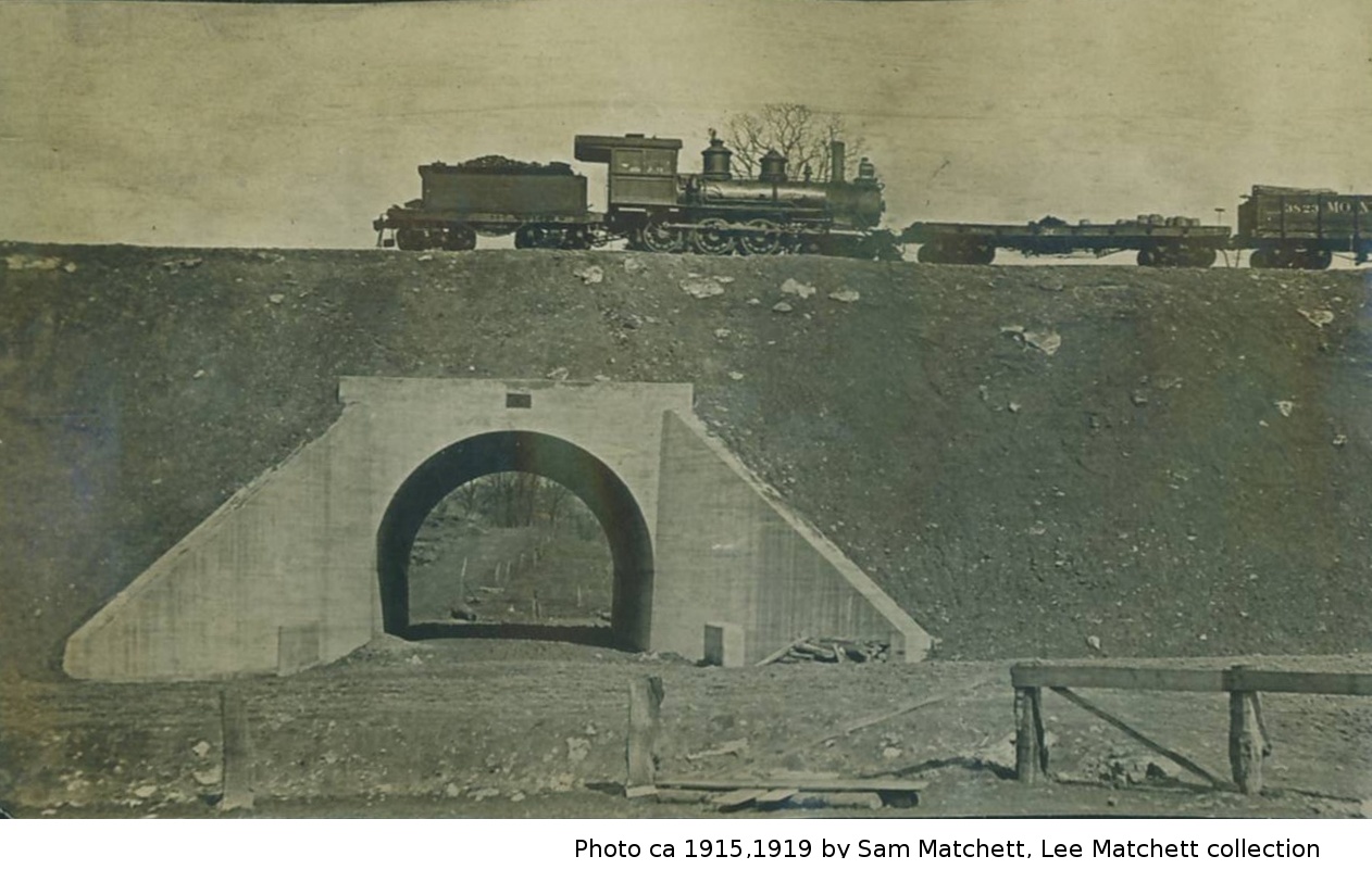
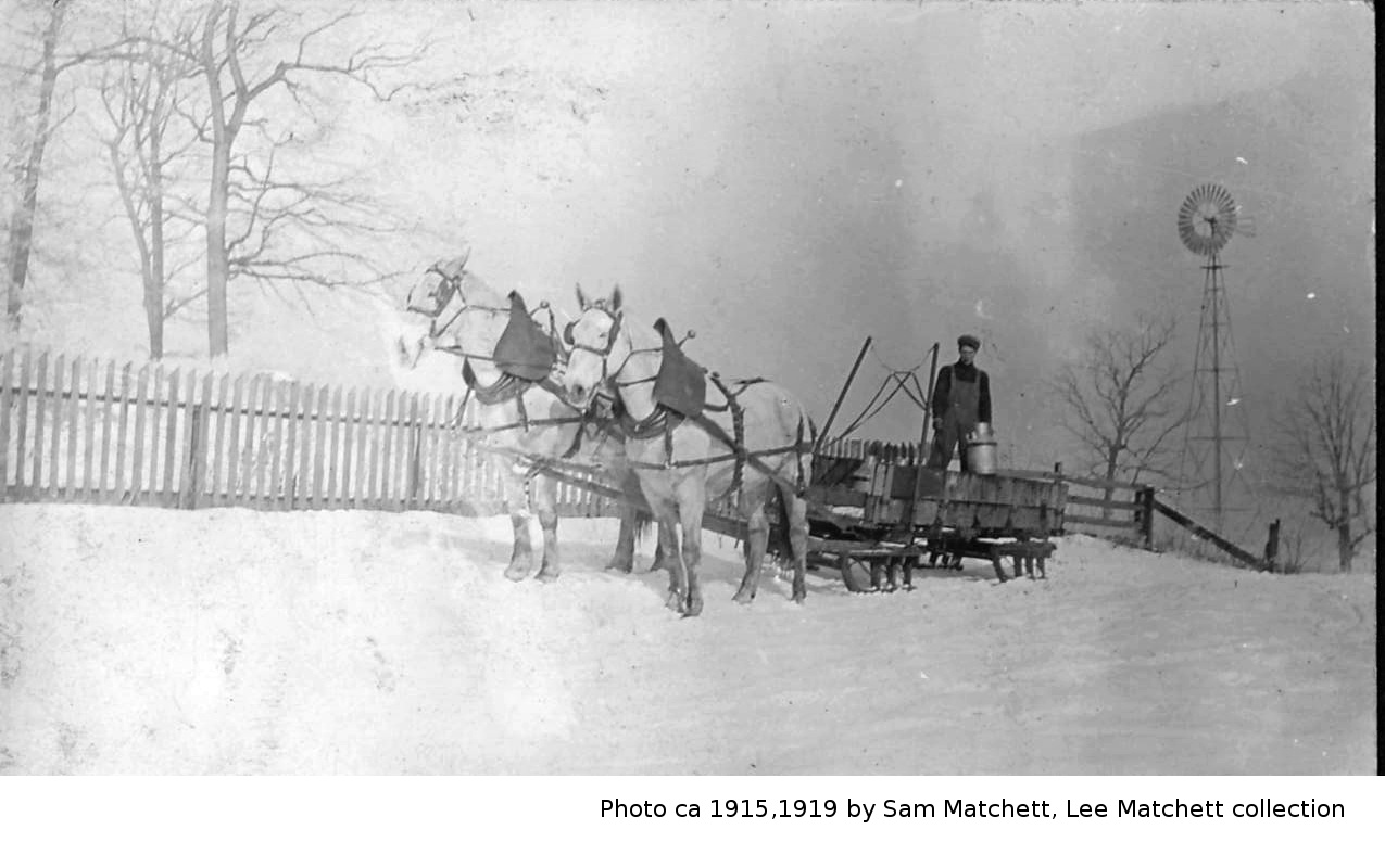
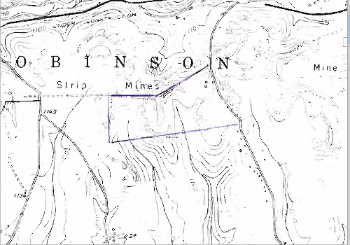
The photos on this page were supplied by Lee Matchett whose grandfather took them around 1915 - 1919. See the accompaning map for the location. I am putting them here at milepost 12 because of the indication of the Stuebenville Pike intersection with the Montour. I also wonder if the milk images could have been with the Moon Run railroad. Most likely they were with the farm location though. I thought perhaps the Moon Run because of the looks of the locomotive. As more information and research occurs we may be able to pinpoint the location. Here is the description of the photos supplied by Lee Matchett. These photos that were taken by my grandfather around 1915 - 1919 or so. One is marked as Montour RR and on another you can see Montour on a gondola. The others may or may not be Montour, but you can decide. My grandfather grew up on a dairy farm located on Candor Rd just south of what is now route 22/30, Steubenville Pike, directly west of the Champion Coal bog pile, and not far from what had been the processing plant. Most of his photos, as near as I can tell, were taken locally. You would probably know better than I since I don't live in the area and only visit occasionally. I am attaching a topographic map showing the location of the farm. Based on the property deed description and family lore, the broken line on the north border of the property was the original Steubenville Pike in the late 1800's. It was later moved north to the location shown on this map then moved a little south again when the four lane was built. Knowing that milk was transported by horse drawn wagon (or sled in winter), it would make sense that they would take it to the nearest possible location. On the topo map, looking to the east, there are rail lines at the Champion strip mine site and they cross what was then Steubenville Pike. It would seem to me that is the closest and most likely location to meet the train. Whether that railroad is Montour or Moon Run I have no idea. That question is for your experts. Also on the attachment are photos from the PA turnpike site; one showing the current end of the expressway at route 22, and the third page locates our property right where the label says Candor Road on the west (near) side of Candor Road and where you see fewer trees. Those will help you locate the property using current landmarks. Hope these help. Click each photo for a larger image.
|